You are here: Home > Network List > G - GEOSCOPE Stations List
> Station KIP Kipapa, Hawaii, USA > Earthquake Result Viewer
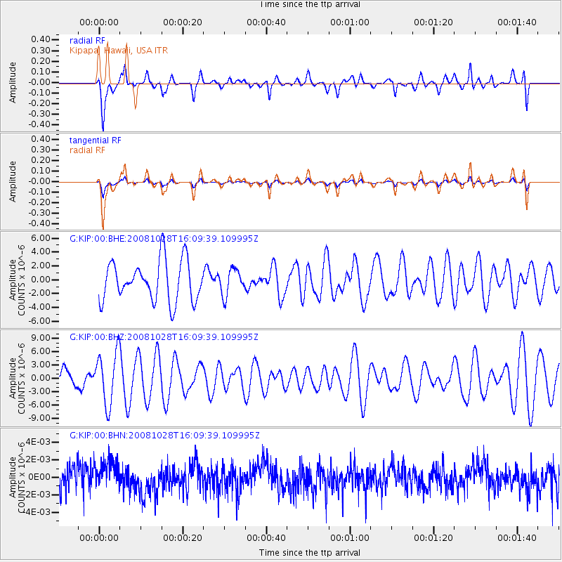
KIP Kipapa, Hawaii, USA - Earthquake Result Viewer
*The percent match for this event was below the threshold and hence no stack was calculated.
| Earthquake location: |
Near N Coast Of New Guinea, P.N.G. |
| Earthquake latitude/longitude: |
-3.5/145.9 |
| Earthquake time(UTC): |
2008/10/28 (302) 16:00:03 GMT |
| Earthquake Depth: |
18 km |
| Earthquake Magnitude: |
5.5 MB, 5.9 MS, 6.0 MW, 6.0 MW |
| Earthquake Catalog/Contributor: |
WHDF/NEIC |
|
| Network: |
G GEOSCOPE |
| Station: |
KIP Kipapa, Hawaii, USA |
| Lat/Lon: |
21.42 N/158.01 W |
| Elevation: |
70 m |
|
| Distance: |
60.2 deg |
| Az: |
63.013 deg |
| Baz: |
252.676 deg |
| Ray Param: |
$rayparam |
*The percent match for this event was below the threshold and hence was not used in the summary stack. |
|
| Radial Match: |
59.492077 % |
| Radial Bump: |
400 |
| Transverse Match: |
59.479836 % |
| Transverse Bump: |
400 |
| SOD ConfigId: |
2560 |
| Insert Time: |
2010-02-26 23:30:18.025 +0000 |
| GWidth: |
2.5 |
| Max Bumps: |
400 |
| Tol: |
0.001 |
|
Signal To Noise
| Channel | StoN | STA | LTA |
| G:KIP:00:BHZ:20081028T16:09:39.109995Z | 2.0108325 | 6.045346E-6 | 3.0063895E-6 |
| G:KIP:00:BHN:20081028T16:09:39.109995Z | 1.064936 | 1.6514146E-9 | 1.5507172E-9 |
| G:KIP:00:BHE:20081028T16:09:39.109995Z | 0.65293366 | 1.9074823E-6 | 2.9214032E-6 |
| Arrivals |
| Ps | |
| PpPs | |
| PsPs/PpSs | |


