You are here: Home > Network List > G - GEOSCOPE Stations List
> Station KIP Kipapa, Hawai, U.S.A. (Pacific Ocean) > Earthquake Result Viewer
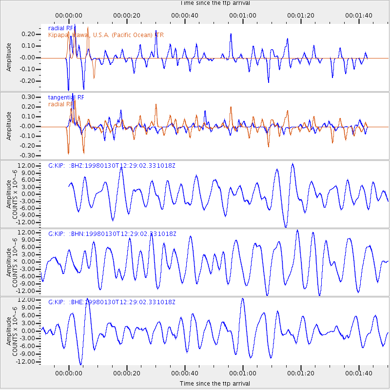
KIP Kipapa, Hawai, U.S.A. (Pacific Ocean) - Earthquake Result Viewer
*The percent match for this event was below the threshold and hence no stack was calculated.
| Earthquake location: |
Near Coast Of Northern Chile |
| Earthquake latitude/longitude: |
-23.9/-70.2 |
| Earthquake time(UTC): |
1998/01/30 (030) 12:16:08 GMT |
| Earthquake Depth: |
42 km |
| Earthquake Magnitude: |
6.3 MB, 6.5 MS, 7.0 UNKNOWN, 6.7 ME |
| Earthquake Catalog/Contributor: |
WHDF/NEIC |
|
| Network: |
G GEOSCOPE |
| Station: |
KIP Kipapa, Hawai, U.S.A. (Pacific Ocean) |
| Lat/Lon: |
21.42 N/158.01 W |
| Elevation: |
70 m |
|
| Distance: |
96.5 deg |
| Az: |
290.423 deg |
| Baz: |
113.005 deg |
| Ray Param: |
$rayparam |
*The percent match for this event was below the threshold and hence was not used in the summary stack. |
|
| Radial Match: |
51.143307 % |
| Radial Bump: |
349 |
| Transverse Match: |
40.87019 % |
| Transverse Bump: |
261 |
| SOD ConfigId: |
4480 |
| Insert Time: |
2010-02-26 23:30:18.735 +0000 |
| GWidth: |
2.5 |
| Max Bumps: |
400 |
| Tol: |
0.001 |
|
Signal To Noise
| Channel | StoN | STA | LTA |
| G:KIP: :BHN:19980130T12:29:02.331018Z | 0.6741025 | 3.0422236E-6 | 4.5129987E-6 |
| G:KIP: :BHE:19980130T12:29:02.331018Z | 2.8866959 | 7.0569113E-6 | 2.4446326E-6 |
| G:KIP: :BHZ:19980130T12:29:02.331018Z | 0.7846131 | 3.932139E-6 | 5.0115646E-6 |
| Arrivals |
| Ps | |
| PpPs | |
| PsPs/PpSs | |


