You are here: Home > Network List > G - GEOSCOPE Stations List
> Station KIP Kipapa, Hawaii, USA > Earthquake Result Viewer
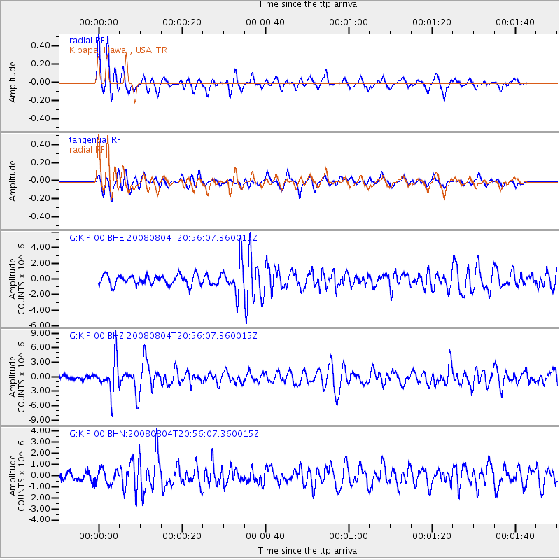
KIP Kipapa, Hawaii, USA - Earthquake Result Viewer
*The percent match for this event was below the threshold and hence no stack was calculated.
| Earthquake location: |
Banda Sea |
| Earthquake latitude/longitude: |
-5.9/130.2 |
| Earthquake time(UTC): |
2008/08/04 (217) 20:45:13 GMT |
| Earthquake Depth: |
174 km |
| Earthquake Magnitude: |
6.1 MB, 6.3 MW, 6.2 MW |
| Earthquake Catalog/Contributor: |
WHDF/NEIC |
|
| Network: |
G GEOSCOPE |
| Station: |
KIP Kipapa, Hawaii, USA |
| Lat/Lon: |
21.42 N/158.01 W |
| Elevation: |
70 m |
|
| Distance: |
75.4 deg |
| Az: |
66.164 deg |
| Baz: |
257.57 deg |
| Ray Param: |
$rayparam |
*The percent match for this event was below the threshold and hence was not used in the summary stack. |
|
| Radial Match: |
77.15834 % |
| Radial Bump: |
400 |
| Transverse Match: |
69.25167 % |
| Transverse Bump: |
400 |
| SOD ConfigId: |
2504 |
| Insert Time: |
2010-02-26 23:30:25.213 +0000 |
| GWidth: |
2.5 |
| Max Bumps: |
400 |
| Tol: |
0.001 |
|
Signal To Noise
| Channel | StoN | STA | LTA |
| G:KIP:00:BHZ:20080804T20:56:07.360015Z | 4.5850053 | 3.4823142E-6 | 7.595006E-7 |
| G:KIP:00:BHN:20080804T20:56:07.360015Z | 1.9960198 | 6.252235E-7 | 3.1323512E-7 |
| G:KIP:00:BHE:20080804T20:56:07.360015Z | 3.2916007 | 2.0482578E-6 | 6.22268E-7 |
| Arrivals |
| Ps | |
| PpPs | |
| PsPs/PpSs | |


