You are here: Home > Network List > G - GEOSCOPE Stations List
> Station KIP Kipapa, Hawaii, USA > Earthquake Result Viewer
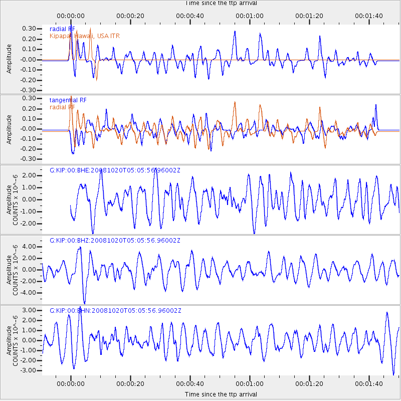
KIP Kipapa, Hawaii, USA - Earthquake Result Viewer
*The percent match for this event was below the threshold and hence no stack was calculated.
| Earthquake location: |
Minahassa Peninsula, Sulawesi |
| Earthquake latitude/longitude: |
0.1/120.7 |
| Earthquake time(UTC): |
2008/10/20 (294) 04:54:19 GMT |
| Earthquake Depth: |
102 km |
| Earthquake Magnitude: |
6.1 MB, 5.9 MW, 5.8 MW |
| Earthquake Catalog/Contributor: |
WHDF/NEIC |
|
| Network: |
G GEOSCOPE |
| Station: |
KIP Kipapa, Hawaii, USA |
| Lat/Lon: |
21.42 N/158.01 W |
| Elevation: |
70 m |
|
| Distance: |
81.9 deg |
| Az: |
68.496 deg |
| Baz: |
266.92 deg |
| Ray Param: |
$rayparam |
*The percent match for this event was below the threshold and hence was not used in the summary stack. |
|
| Radial Match: |
46.500973 % |
| Radial Bump: |
400 |
| Transverse Match: |
46.703457 % |
| Transverse Bump: |
400 |
| SOD ConfigId: |
2556 |
| Insert Time: |
2010-02-26 23:30:25.896 +0000 |
| GWidth: |
2.5 |
| Max Bumps: |
400 |
| Tol: |
0.001 |
|
Signal To Noise
| Channel | StoN | STA | LTA |
| G:KIP:00:BHZ:20081020T05:05:56.96002Z | 2.6296477 | 2.885546E-6 | 1.0973129E-6 |
| G:KIP:00:BHN:20081020T05:05:56.96002Z | 1.9739664 | 2.0417256E-6 | 1.0343265E-6 |
| G:KIP:00:BHE:20081020T05:05:56.96002Z | 1.1830608 | 1.2909276E-6 | 1.091176E-6 |
| Arrivals |
| Ps | |
| PpPs | |
| PsPs/PpSs | |


