You are here: Home > Network List > CI - Caltech Regional Seismic Network Stations List
> Station RCT Rector, Visalia, CA, USA > Earthquake Result Viewer
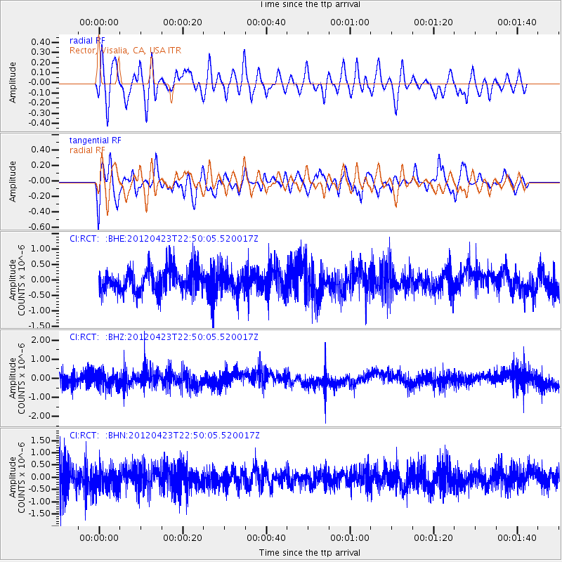
RCT Rector, Visalia, CA, USA - Earthquake Result Viewer
*The percent match for this event was below the threshold and hence no stack was calculated.
| Earthquake location: |
Kuril Islands |
| Earthquake latitude/longitude: |
48.4/154.7 |
| Earthquake time(UTC): |
2012/04/23 (114) 22:40:22 GMT |
| Earthquake Depth: |
31 km |
| Earthquake Magnitude: |
5.6 MW, 5.2 MS, 5.4 MB, 5.7 MW |
| Earthquake Catalog/Contributor: |
WHDF/NEIC |
|
| Network: |
CI Caltech Regional Seismic Network |
| Station: |
RCT Rector, Visalia, CA, USA |
| Lat/Lon: |
36.31 N/119.24 W |
| Elevation: |
107 m |
|
| Distance: |
61.5 deg |
| Az: |
66.46 deg |
| Baz: |
310.852 deg |
| Ray Param: |
$rayparam |
*The percent match for this event was below the threshold and hence was not used in the summary stack. |
|
| Radial Match: |
57.05847 % |
| Radial Bump: |
400 |
| Transverse Match: |
58.691372 % |
| Transverse Bump: |
400 |
| SOD ConfigId: |
446234 |
| Insert Time: |
2012-07-21 12:49:43.775 +0000 |
| GWidth: |
2.5 |
| Max Bumps: |
400 |
| Tol: |
0.001 |
|
Signal To Noise
| Channel | StoN | STA | LTA |
| CI:RCT: :BHZ:20120423T22:50:05.520017Z | 1.3720214 | 3.7824267E-7 | 2.7568277E-7 |
| CI:RCT: :BHN:20120423T22:50:05.520017Z | 0.77667123 | 4.4017884E-7 | 5.6675054E-7 |
| CI:RCT: :BHE:20120423T22:50:05.520017Z | 0.9880886 | 3.7372362E-7 | 3.7822883E-7 |
| Arrivals |
| Ps | |
| PpPs | |
| PsPs/PpSs | |


