You are here: Home > Network List > IW - Intermountain West Stations List
> Station DLMT Dillon, Montana, USA > Earthquake Result Viewer
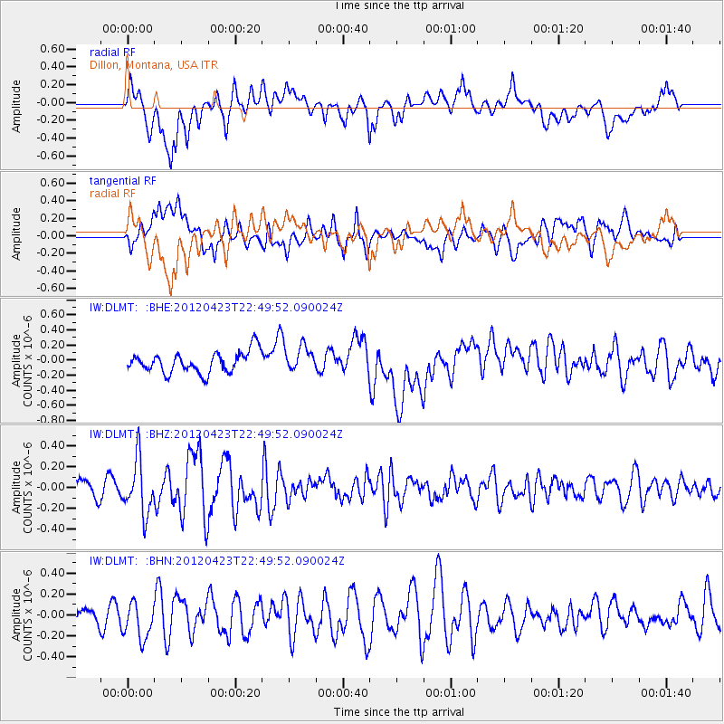
DLMT Dillon, Montana, USA - Earthquake Result Viewer
*The percent match for this event was below the threshold and hence no stack was calculated.
| Earthquake location: |
Kuril Islands |
| Earthquake latitude/longitude: |
48.4/154.7 |
| Earthquake time(UTC): |
2012/04/23 (114) 22:40:22 GMT |
| Earthquake Depth: |
31 km |
| Earthquake Magnitude: |
5.6 MW, 5.2 MS, 5.4 MB, 5.7 MW |
| Earthquake Catalog/Contributor: |
WHDF/NEIC |
|
| Network: |
IW Intermountain West |
| Station: |
DLMT Dillon, Montana, USA |
| Lat/Lon: |
45.36 N/112.60 W |
| Elevation: |
1569 m |
|
| Distance: |
59.5 deg |
| Az: |
54.784 deg |
| Baz: |
309.438 deg |
| Ray Param: |
$rayparam |
*The percent match for this event was below the threshold and hence was not used in the summary stack. |
|
| Radial Match: |
65.23325 % |
| Radial Bump: |
400 |
| Transverse Match: |
53.631702 % |
| Transverse Bump: |
400 |
| SOD ConfigId: |
446234 |
| Insert Time: |
2012-07-21 12:53:25.354 +0000 |
| GWidth: |
2.5 |
| Max Bumps: |
400 |
| Tol: |
0.001 |
|
Signal To Noise
| Channel | StoN | STA | LTA |
| IW:DLMT: :BHZ:20120423T22:49:52.090024Z | 3.3708396 | 2.5889054E-7 | 7.680298E-8 |
| IW:DLMT: :BHN:20120423T22:49:52.090024Z | 0.955964 | 1.7522198E-7 | 1.8329351E-7 |
| IW:DLMT: :BHE:20120423T22:49:52.090024Z | 1.1719695 | 1.6439323E-7 | 1.4027091E-7 |
| Arrivals |
| Ps | |
| PpPs | |
| PsPs/PpSs | |


