You are here: Home > Network List > G - GEOSCOPE Stations List
> Station KIP Kipapa, Hawaii, USA > Earthquake Result Viewer
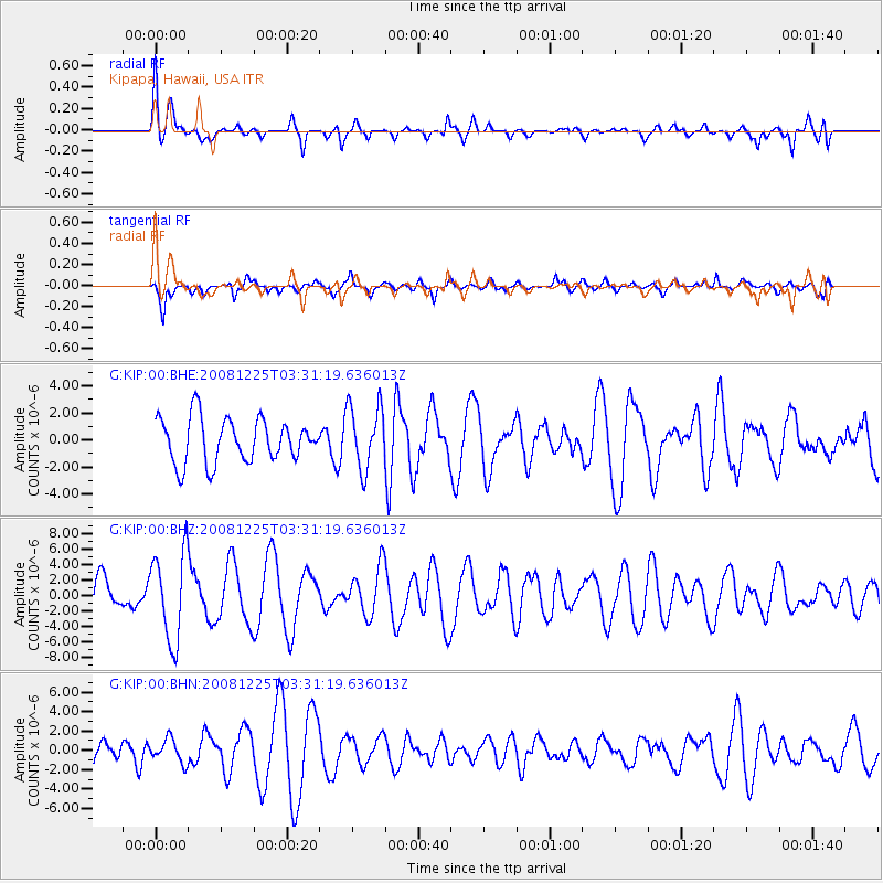
KIP Kipapa, Hawaii, USA - Earthquake Result Viewer
*The percent match for this event was below the threshold and hence no stack was calculated.
| Earthquake location: |
Mindanao, Philippines |
| Earthquake latitude/longitude: |
5.8/125.4 |
| Earthquake time(UTC): |
2008/12/25 (360) 03:20:29 GMT |
| Earthquake Depth: |
211 km |
| Earthquake Magnitude: |
6.1 MB, 6.3 MW, 6.3 MW |
| Earthquake Catalog/Contributor: |
WHDF/NEIC |
|
| Network: |
G GEOSCOPE |
| Station: |
KIP Kipapa, Hawaii, USA |
| Lat/Lon: |
21.42 N/158.01 W |
| Elevation: |
70 m |
|
| Distance: |
75.5 deg |
| Az: |
69.448 deg |
| Baz: |
270.542 deg |
| Ray Param: |
$rayparam |
*The percent match for this event was below the threshold and hence was not used in the summary stack. |
|
| Radial Match: |
56.14299 % |
| Radial Bump: |
400 |
| Transverse Match: |
67.577354 % |
| Transverse Bump: |
400 |
| SOD ConfigId: |
2658 |
| Insert Time: |
2010-02-26 23:30:49.054 +0000 |
| GWidth: |
2.5 |
| Max Bumps: |
400 |
| Tol: |
0.001 |
|
Signal To Noise
| Channel | StoN | STA | LTA |
| G:KIP:00:BHZ:20081225T03:31:19.636013Z | 1.7977618 | 5.765298E-6 | 3.206931E-6 |
| G:KIP:00:BHN:20081225T03:31:19.636013Z | 0.8448734 | 1.2237126E-6 | 1.4483976E-6 |
| G:KIP:00:BHE:20081225T03:31:19.636013Z | 1.4541017 | 2.3488958E-6 | 1.6153587E-6 |
| Arrivals |
| Ps | |
| PpPs | |
| PsPs/PpSs | |


