J31A Geddes, SD, USA - Earthquake Result Viewer
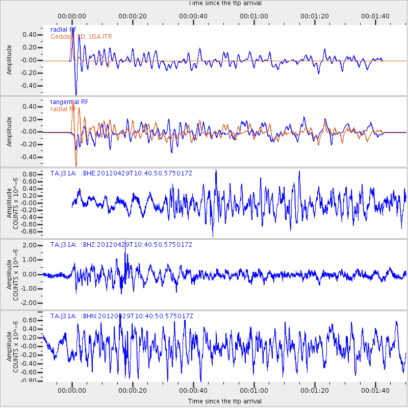
Earthquake location: Near East Coast Of Honshu, Japan
Earthquake latitude/longitude: 35.6/140.3
Earthquake time(UTC): 2012/04/29 (120) 10:28:51 GMT
Earthquake Depth: 44 km
Earthquake Magnitude: 5.6 MB, 5.2 MS, 5.8 MW, 5.8 MW
Earthquake Catalog/Contributor: WHDF/NEIC
Network: TA USArray Transportable Network (new EarthScope stations)
Station: J31A Geddes, SD, USA
Lat/Lon: 43.29 N/98.74 W
Elevation: 491 m
Distance: 84.8 deg
Az: 38.978 deg
Baz: 315.405 deg
Ray Param: 0.045136124
Estimated Moho Depth: 22.5 km
Estimated Crust Vp/Vs: 1.73
Assumed Crust Vp: 6.53 km/s
Estimated Crust Vs: 3.78 km/s
Estimated Crust Poisson's Ratio: 0.25
Radial Match: 80.51748 %
Radial Bump: 400
Transverse Match: 69.23629 %
Transverse Bump: 400
SOD ConfigId: 446234
Insert Time: 2012-07-28 06:35:15.068 +0000
GWidth: 2.5
Max Bumps: 400
Tol: 0.001

Signal To Noise

ChannelStoNSTALTA
TA:J31A: :BHZ:20120429T10:40:50.575017Z3.26503564.2089871E-71.2891091E-7
TA:J31A: :BHN:20120429T10:40:50.575017Z1.71226162.5232973E-71.4736634E-7
TA:J31A: :BHE:20120429T10:40:50.575017Z1.56626382.3881503E-71.5247434E-7
Arrivals
Ps2.6 SECOND
PpPs9.2 SECOND
PsPs/PpSs12 SECOND