You are here: Home > Network List > TA - USArray Transportable Network (new EarthScope stations) Stations List
> Station E38A The Farm, Brule, WI, USA > Earthquake Result Viewer
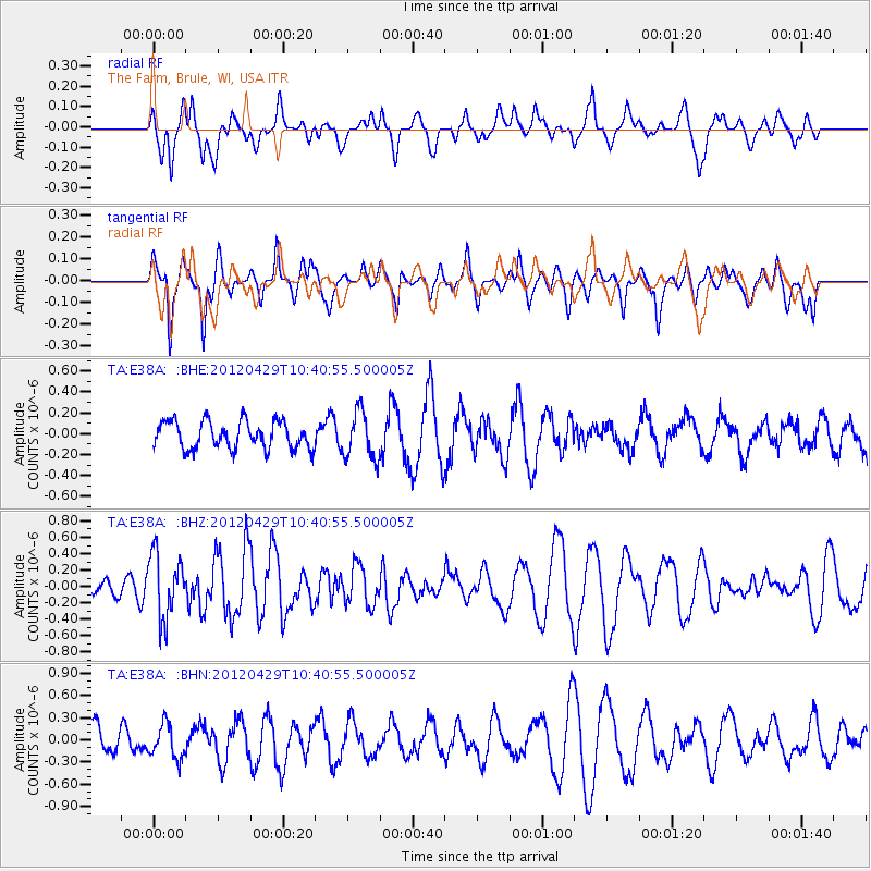
E38A The Farm, Brule, WI, USA - Earthquake Result Viewer
*The percent match for this event was below the threshold and hence no stack was calculated.
| Earthquake location: |
Near East Coast Of Honshu, Japan |
| Earthquake latitude/longitude: |
35.6/140.3 |
| Earthquake time(UTC): |
2012/04/29 (120) 10:28:51 GMT |
| Earthquake Depth: |
44 km |
| Earthquake Magnitude: |
5.6 MB, 5.2 MS, 5.8 MW, 5.8 MW |
| Earthquake Catalog/Contributor: |
WHDF/NEIC |
|
| Network: |
TA USArray Transportable Network (new EarthScope stations) |
| Station: |
E38A The Farm, Brule, WI, USA |
| Lat/Lon: |
46.61 N/91.55 W |
| Elevation: |
341 m |
|
| Distance: |
85.8 deg |
| Az: |
32.958 deg |
| Baz: |
319.978 deg |
| Ray Param: |
$rayparam |
*The percent match for this event was below the threshold and hence was not used in the summary stack. |
|
| Radial Match: |
57.670307 % |
| Radial Bump: |
400 |
| Transverse Match: |
69.256775 % |
| Transverse Bump: |
400 |
| SOD ConfigId: |
446234 |
| Insert Time: |
2012-07-28 06:41:50.574 +0000 |
| GWidth: |
2.5 |
| Max Bumps: |
400 |
| Tol: |
0.001 |
|
Signal To Noise
| Channel | StoN | STA | LTA |
| TA:E38A: :BHZ:20120429T10:40:55.500005Z | 3.1355228 | 3.8911764E-7 | 1.2409976E-7 |
| TA:E38A: :BHN:20120429T10:40:55.500005Z | 1.3515818 | 2.2883299E-7 | 1.6930754E-7 |
| TA:E38A: :BHE:20120429T10:40:55.500005Z | 1.7490166 | 2.2727554E-7 | 1.2994475E-7 |
| Arrivals |
| Ps | |
| PpPs | |
| PsPs/PpSs | |


