KOG Kourou, French Guyana - Earthquake Result Viewer
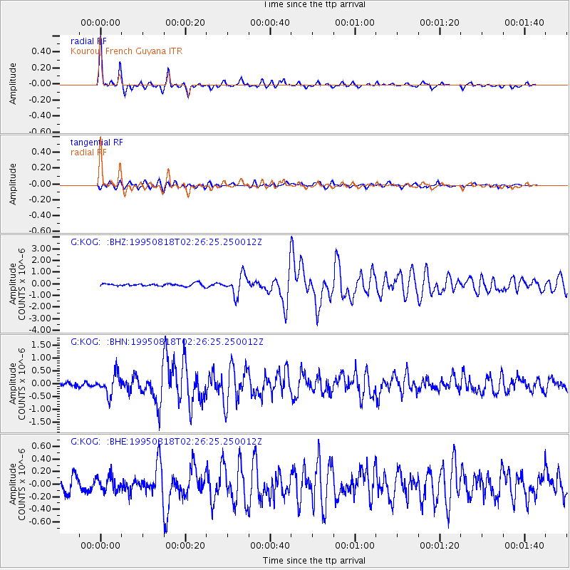
Earthquake location: South Sandwich Islands Region
Earthquake latitude/longitude: -55.9/-28.9
Earthquake time(UTC): 1995/08/18 (230) 02:16:26 GMT
Earthquake Depth: 36 km
Earthquake Magnitude: 5.6 MB, 5.8 MS, 5.7 UNKNOWN, 6.3 MW
Earthquake Catalog/Contributor: WHDF/NEIC
Network: G GEOSCOPE
Station: KOG Kourou, French Guyana
Lat/Lon: 5.21 N/52.73 W
Elevation: 10 m
Distance: 64.0 deg
Az: 333.399 deg
Baz: 165.331 deg
Ray Param: 0.059156854
Estimated Moho Depth: 40.0 km
Estimated Crust Vp/Vs: 1.73
Assumed Crust Vp: 6.472 km/s
Estimated Crust Vs: 3.752 km/s
Estimated Crust Poisson's Ratio: 0.25
Radial Match: 96.44584 %
Radial Bump: 302
Transverse Match: 86.246544 %
Transverse Bump: 400
SOD ConfigId: 6273
Insert Time: 2010-02-26 23:31:36.666 +0000
GWidth: 2.5
Max Bumps: 400
Tol: 0.001

Signal To Noise

ChannelStoNSTALTA
G:KOG: :BHN:19950818T02:26:25.250012Z6.23500254.0969076E-76.570819E-8
G:KOG: :BHE:19950818T02:26:25.250012Z1.12361111.1629558E-71.0350163E-7
G:KOG: :BHZ:19950818T02:26:25.250012Z8.0257478.662078E-71.0792862E-7
Arrivals
Ps4.7 SECOND
PpPs16 SECOND
PsPs/PpSs21 SECOND