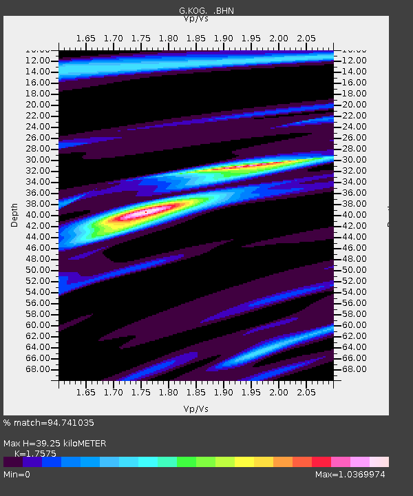
KOG Kourou, French Guyana - Earthquake Result Viewer
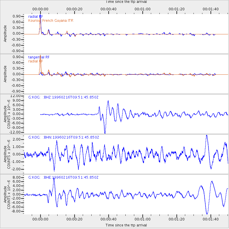
Earthquake location: North Of Ascension Island
Earthquake latitude/longitude: -1.5/-15.2
Earthquake time(UTC): 1996/02/16 (047) 09:44:58 GMT
Earthquake Depth: 10 km
Earthquake Magnitude: 6.0 MB, 6.3 MS, 6.5 UNKNOWN, 6.4 MW
Earthquake Catalog/Contributor: WHDF/NEIC
Network: G GEOSCOPE
Station: KOG Kourou, French Guyana
Lat/Lon: 5.21 N/52.73 W
Elevation: 10 m
Distance: 38.1 deg
Az: 280.372 deg
Baz: 99.128 deg
Ray Param: 0.07577989
Estimated Moho Depth: 39.25 km
Estimated Crust Vp/Vs: 1.76
Assumed Crust Vp: 6.472 km/s
Estimated Crust Vs: 3.682 km/s
Estimated Crust Poisson's Ratio: 0.26
Radial Match: 94.741035 %
Radial Bump: 187
Transverse Match: 76.479706 %
Transverse Bump: 400
SOD ConfigId: 6273
Insert Time: 2010-02-26 23:31:43.209 +0000
GWidth: 2.5
Max Bumps: 400
Tol: 0.001

Signal To Noise

ChannelStoNSTALTA
G:KOG: :BHN:19960216T09:51:45.850Z1.2416472.8475353E-72.2933531E-7
G:KOG: :BHE:19960216T09:51:45.850Z6.5877471.0598701E-61.6088507E-7
G:KOG: :BHZ:19960216T09:51:45.850Z5.18258141.5108443E-62.915235E-7
Arrivals
Ps5.0 SECOND
PpPs16 SECOND
PsPs/PpSs20 SECOND