
E31A Nome, ND, USA - Earthquake Result Viewer
| ||||||||||||||||||
| ||||||||||||||||||
| ||||||||||||||||||
|
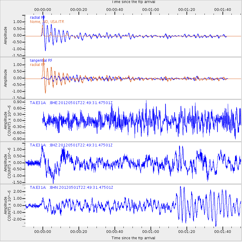
Signal To Noise
| Channel | StoN | STA | LTA |
| TA:E31A: :BHZ:20120501T22:49:31.47501Z | 5.3895063 | 6.6960524E-7 | 1.242424E-7 |
| TA:E31A: :BHN:20120501T22:49:31.47501Z | 3.8391745 | 5.7564637E-7 | 1.4994013E-7 |
| TA:E31A: :BHE:20120501T22:49:31.47501Z | 1.2333927 | 2.4436213E-7 | 1.9812191E-7 |
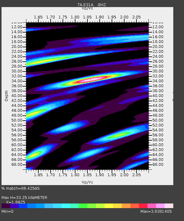
| Arrivals | |
| Ps | 4.8 SECOND |
| PpPs | 14 SECOND |
| PsPs/PpSs | 18 SECOND |

