D34A Park Rapids, MN, USA - Earthquake Result Viewer
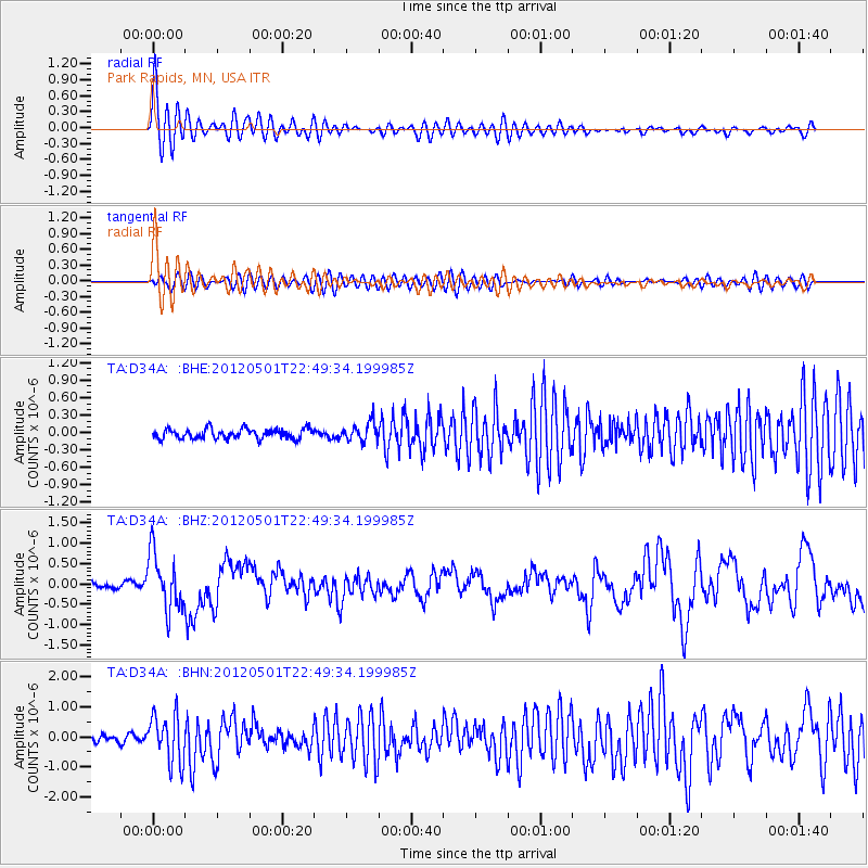
Earthquake location: Near Coast Of Chiapas, Mexico
Earthquake latitude/longitude: 14.4/-92.9
Earthquake time(UTC): 2012/05/01 (122) 22:43:33 GMT
Earthquake Depth: 14 km
Earthquake Magnitude: 5.6 MB, 5.8 MS, 6.0 MW, 5.9 MW
Earthquake Catalog/Contributor: WHDF/NEIC
Network: TA USArray Transportable Network (new EarthScope stations)
Station: D34A Park Rapids, MN, USA
Lat/Lon: 47.09 N/95.20 W
Elevation: 476 m
Distance: 32.7 deg
Az: 357.09 deg
Baz: 175.871 deg
Ray Param: 0.07854691
Estimated Moho Depth: 21.5 km
Estimated Crust Vp/Vs: 2.10
Assumed Crust Vp: 6.419 km/s
Estimated Crust Vs: 3.064 km/s
Estimated Crust Poisson's Ratio: 0.35
Radial Match: 87.33912 %
Radial Bump: 400
Transverse Match: 65.041504 %
Transverse Bump: 400
SOD ConfigId: 446234
Insert Time: 2012-07-28 07:19:26.976 +0000
GWidth: 2.5
Max Bumps: 400
Tol: 0.001

Signal To Noise

ChannelStoNSTALTA
TA:D34A: :BHZ:20120501T22:49:34.199985Z10.0808746.881705E-76.826495E-8
TA:D34A: :BHN:20120501T22:49:34.199985Z6.3680867.966333E-71.2509776E-7
TA:D34A: :BHE:20120501T22:49:34.199985Z1.83883921.5797842E-78.5912035E-8
Arrivals
Ps3.9 SECOND
PpPs9.7 SECOND
PsPs/PpSs14 SECOND