
C33A Trail, MN, USA - Earthquake Result Viewer
| ||||||||||||||||||
| ||||||||||||||||||
| ||||||||||||||||||
|
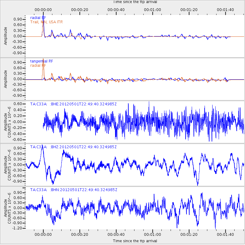
Signal To Noise
| Channel | StoN | STA | LTA |
| TA:C33A: :BHZ:20120501T22:49:40.324985Z | 7.593855 | 5.873221E-7 | 7.734176E-8 |
| TA:C33A: :BHN:20120501T22:49:40.324985Z | 2.686255 | 3.3732545E-7 | 1.2557462E-7 |
| TA:C33A: :BHE:20120501T22:49:40.324985Z | 1.0796869 | 1.7321646E-7 | 1.6043212E-7 |
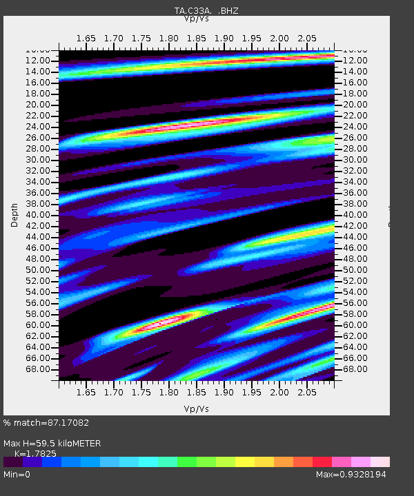
| Arrivals | |
| Ps | 7.8 SECOND |
| PpPs | 24 SECOND |
| PsPs/PpSs | 32 SECOND |

