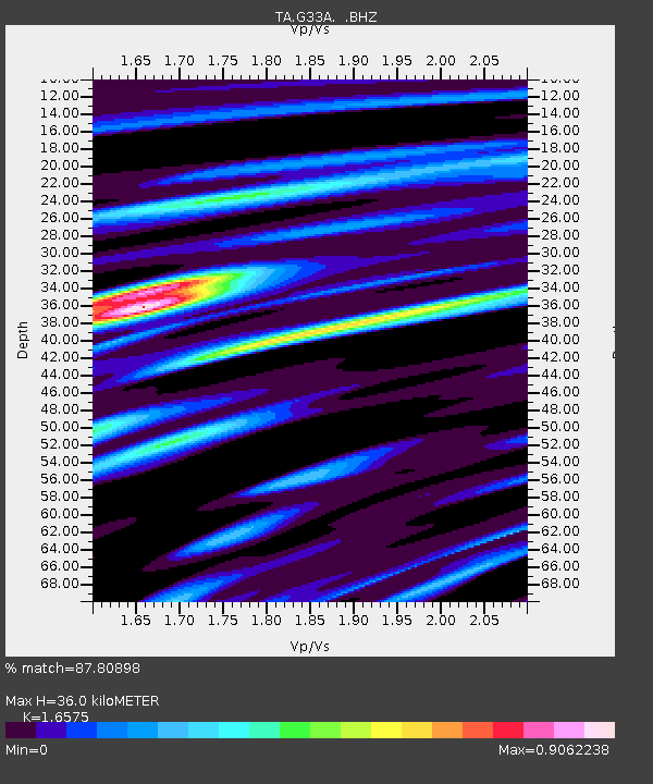
G33A Ortonville, MN, USA - Earthquake Result Viewer
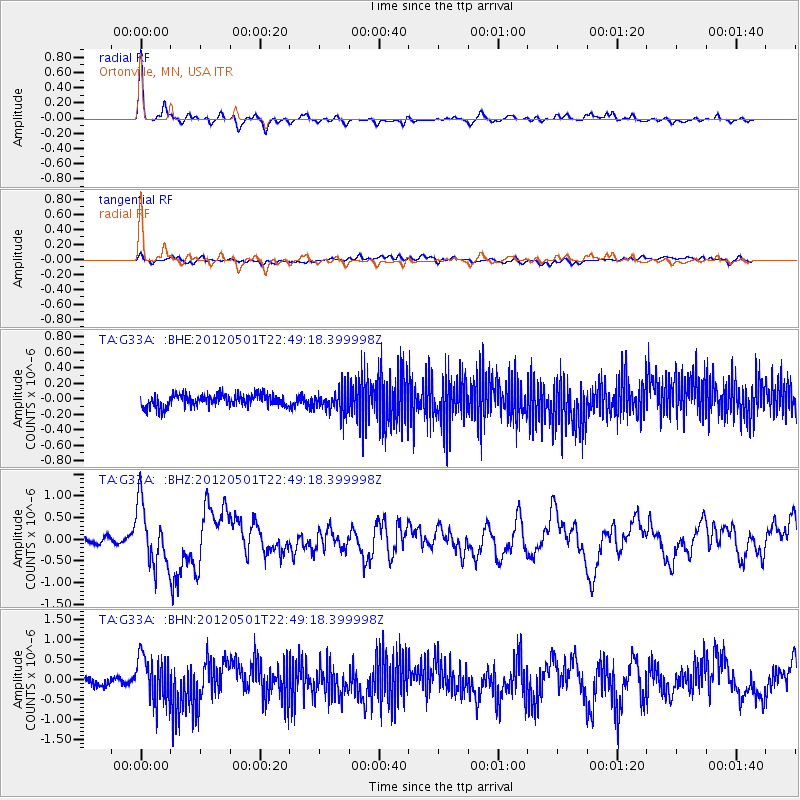
Earthquake location: Near Coast Of Chiapas, Mexico
Earthquake latitude/longitude: 14.4/-92.9
Earthquake time(UTC): 2012/05/01 (122) 22:43:33 GMT
Earthquake Depth: 14 km
Earthquake Magnitude: 5.6 MB, 5.8 MS, 6.0 MW, 5.9 MW
Earthquake Catalog/Contributor: WHDF/NEIC
Network: TA USArray Transportable Network (new EarthScope stations)
Station: G33A Ortonville, MN, USA
Lat/Lon: 45.19 N/96.44 W
Elevation: 338 m
Distance: 30.9 deg
Az: 355.116 deg
Baz: 173.299 deg
Ray Param: 0.079215005
Estimated Moho Depth: 36.0 km
Estimated Crust Vp/Vs: 1.66
Assumed Crust Vp: 6.552 km/s
Estimated Crust Vs: 3.953 km/s
Estimated Crust Poisson's Ratio: 0.21
Radial Match: 87.80898 %
Radial Bump: 332
Transverse Match: 53.276592 %
Transverse Bump: 400
SOD ConfigId: 446234
Insert Time: 2012-07-28 07:21:21.091 +0000
GWidth: 2.5
Max Bumps: 400
Tol: 0.001

Signal To Noise

ChannelStoNSTALTA
TA:G33A: :BHZ:20120501T22:49:18.399998Z8.1815337.0177157E-78.577507E-8
TA:G33A: :BHN:20120501T22:49:18.399998Z4.8872515.8346745E-71.1938562E-7
TA:G33A: :BHE:20120501T22:49:18.399998Z1.9800651.537215E-77.763458E-8
Arrivals
Ps4.0 SECOND
PpPs13 SECOND
PsPs/PpSs17 SECOND