You are here: Home > Network List > TA - USArray Transportable Network (new EarthScope stations) Stations List
> Station A32A Rocking H Ranch, Lancaster, MN, USA > Earthquake Result Viewer
A32A Rocking H Ranch, Lancaster, MN, USA - Earthquake Result Viewer

| Earthquake location: |
Near Coast Of Chiapas, Mexico |
| Earthquake latitude/longitude: |
14.4/-92.9 |
| Earthquake time(UTC): |
2012/05/01 (122) 22:43:33 GMT |
| Earthquake Depth: |
14 km |
| Earthquake Magnitude: |
5.6 MB, 5.8 MS, 6.0 MW, 5.9 MW |
| Earthquake Catalog/Contributor: |
WHDF/NEIC |
|
| Network: |
TA USArray Transportable Network (new EarthScope stations) |
| Station: |
A32A Rocking H Ranch, Lancaster, MN, USA |
| Lat/Lon: |
48.92 N/96.49 W |
| Elevation: |
322 m |
|
| Distance: |
34.6 deg |
| Az: |
355.818 deg |
| Baz: |
173.85 deg |
| Ray Param: |
0.07766395 |
| Estimated Moho Depth: |
41.25 km |
| Estimated Crust Vp/Vs: |
1.91 |
| Assumed Crust Vp: |
6.498 km/s |
| Estimated Crust Vs: |
3.397 km/s |
| Estimated Crust Poisson's Ratio: |
0.31 |
|
| Radial Match: |
84.39489 % |
| Radial Bump: |
400 |
| Transverse Match: |
68.93248 % |
| Transverse Bump: |
400 |
| SOD ConfigId: |
446234 |
| Insert Time: |
2012-07-28 07:21:59.135 +0000 |
| GWidth: |
2.5 |
| Max Bumps: |
400 |
| Tol: |
0.001 |
|
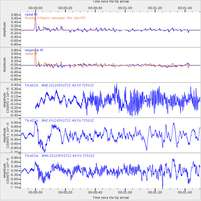
Signal To Noise
| Channel | StoN | STA | LTA |
| TA:A32A: :BHZ:20120501T22:49:50.72501Z | 6.442422 | 6.358024E-7 | 9.868996E-8 |
| TA:A32A: :BHN:20120501T22:49:50.72501Z | 3.7099824 | 3.8074714E-7 | 1.02627745E-7 |
| TA:A32A: :BHE:20120501T22:49:50.72501Z | 1.5008053 | 1.5524606E-7 | 1.0344184E-7 |
| Arrivals |
| Ps | 6.2 SECOND |
| PpPs | 17 SECOND |
| PsPs/PpSs | 23 SECOND |


