H40A Chili, WI, USA - Earthquake Result Viewer
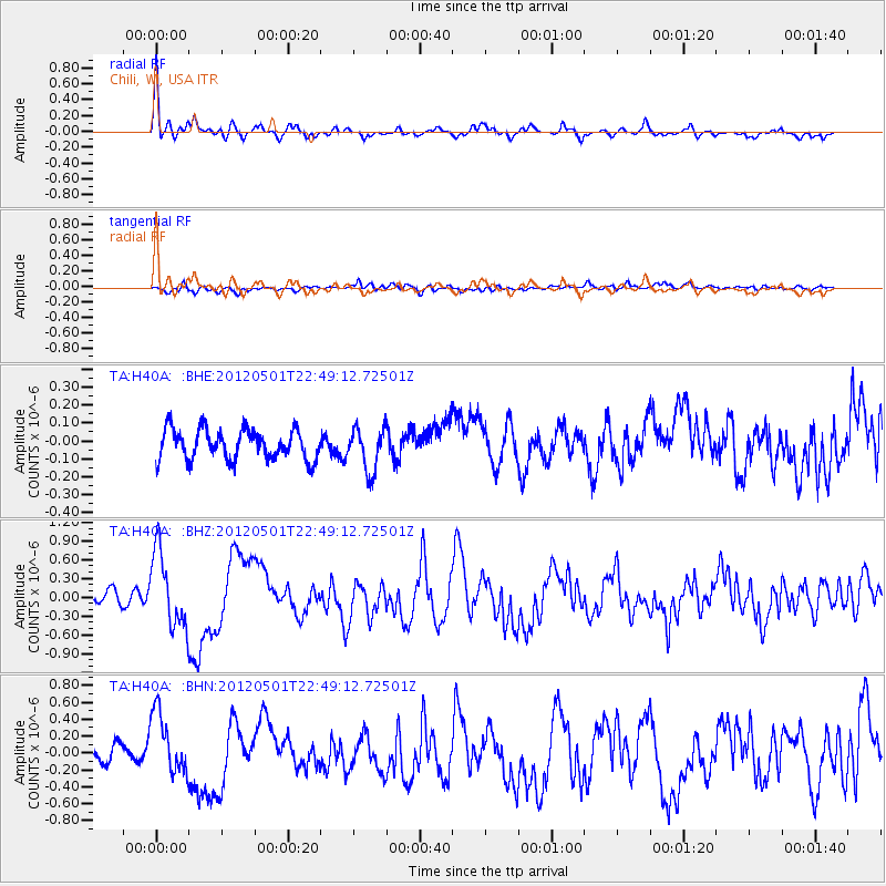
Earthquake location: Near Coast Of Chiapas, Mexico
Earthquake latitude/longitude: 14.4/-92.9
Earthquake time(UTC): 2012/05/01 (122) 22:43:33 GMT
Earthquake Depth: 14 km
Earthquake Magnitude: 5.6 MB, 5.8 MS, 6.0 MW, 5.9 MW
Earthquake Catalog/Contributor: WHDF/NEIC
Network: TA USArray Transportable Network (new EarthScope stations)
Station: H40A Chili, WI, USA
Lat/Lon: 44.62 N/90.39 W
Elevation: 372 m
Distance: 30.2 deg
Az: 3.557 deg
Baz: 184.83 deg
Ray Param: 0.079384066
Estimated Moho Depth: 56.0 km
Estimated Crust Vp/Vs: 1.62
Assumed Crust Vp: 6.571 km/s
Estimated Crust Vs: 4.056 km/s
Estimated Crust Poisson's Ratio: 0.19
Radial Match: 86.014114 %
Radial Bump: 375
Transverse Match: 59.995003 %
Transverse Bump: 400
SOD ConfigId: 446234
Insert Time: 2012-07-28 07:22:18.153 +0000
GWidth: 2.5
Max Bumps: 400
Tol: 0.001

Signal To Noise

ChannelStoNSTALTA
TA:H40A: :BHZ:20120501T22:49:12.72501Z7.3707375.974729E-78.106013E-8
TA:H40A: :BHN:20120501T22:49:12.72501Z4.3102723.7302118E-78.654237E-8
TA:H40A: :BHE:20120501T22:49:12.72501Z1.43268761.18705344E-78.285501E-8
Arrivals
Ps5.8 SECOND
PpPs20 SECOND
PsPs/PpSs26 SECOND