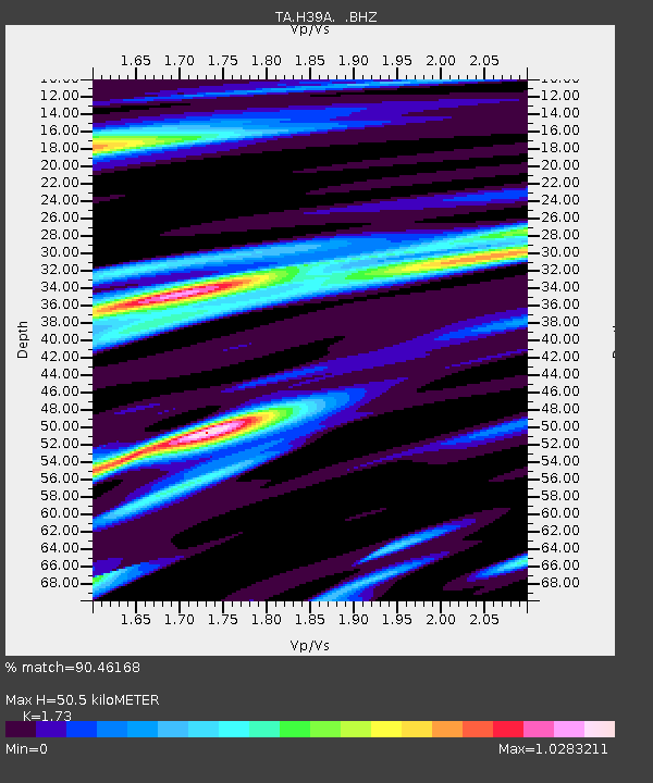
H39A Augusta, WI, USA - Earthquake Result Viewer
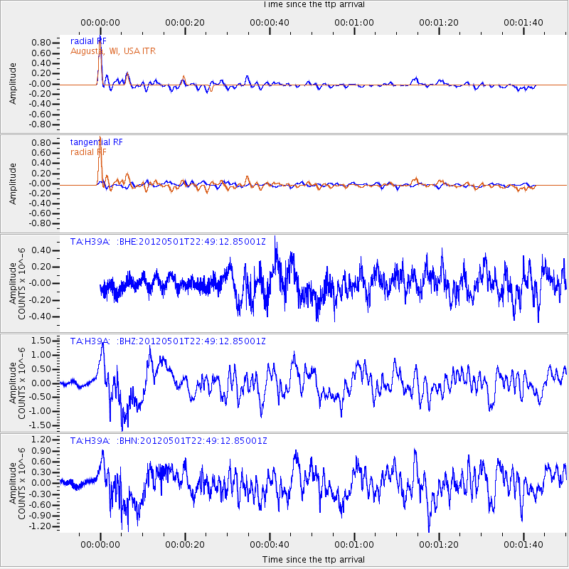
Earthquake location: Near Coast Of Chiapas, Mexico
Earthquake latitude/longitude: 14.4/-92.9
Earthquake time(UTC): 2012/05/01 (122) 22:43:33 GMT
Earthquake Depth: 14 km
Earthquake Magnitude: 5.6 MB, 5.8 MS, 6.0 MW, 5.9 MW
Earthquake Catalog/Contributor: WHDF/NEIC
Network: TA USArray Transportable Network (new EarthScope stations)
Station: H39A Augusta, WI, USA
Lat/Lon: 44.68 N/91.28 W
Elevation: 345 m
Distance: 30.2 deg
Az: 2.287 deg
Baz: 183.107 deg
Ray Param: 0.079380535
Estimated Moho Depth: 50.5 km
Estimated Crust Vp/Vs: 1.73
Assumed Crust Vp: 6.571 km/s
Estimated Crust Vs: 3.798 km/s
Estimated Crust Poisson's Ratio: 0.25
Radial Match: 90.46168 %
Radial Bump: 383
Transverse Match: 71.46631 %
Transverse Bump: 400
SOD ConfigId: 446234
Insert Time: 2012-07-28 07:22:26.916 +0000
GWidth: 2.5
Max Bumps: 400
Tol: 0.001

Signal To Noise

ChannelStoNSTALTA
TA:H39A: :BHZ:20120501T22:49:12.85001Z12.8225786.7175563E-75.2388494E-8
TA:H39A: :BHN:20120501T22:49:12.85001Z4.3275654.3567383E-71.0067413E-7
TA:H39A: :BHE:20120501T22:49:12.85001Z2.5180091.8071083E-77.1767346E-8
Arrivals
Ps6.1 SECOND
PpPs19 SECOND
PsPs/PpSs25 SECOND