F39A Loretta, WI, USA - Earthquake Result Viewer
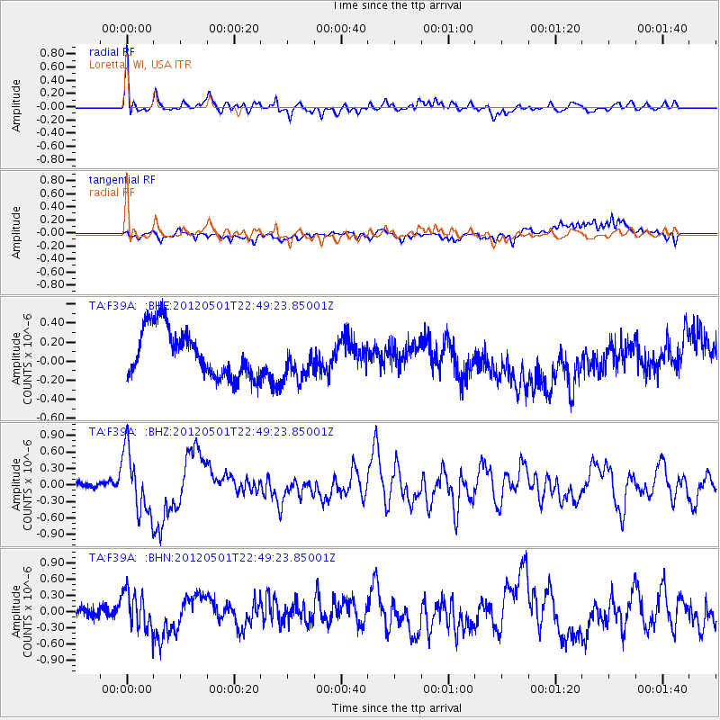
Earthquake location: Near Coast Of Chiapas, Mexico
Earthquake latitude/longitude: 14.4/-92.9
Earthquake time(UTC): 2012/05/01 (122) 22:43:33 GMT
Earthquake Depth: 14 km
Earthquake Magnitude: 5.6 MB, 5.8 MS, 6.0 MW, 5.9 MW
Earthquake Catalog/Contributor: WHDF/NEIC
Network: TA USArray Transportable Network (new EarthScope stations)
Station: F39A Loretta, WI, USA
Lat/Lon: 45.92 N/90.92 W
Elevation: 440 m
Distance: 31.5 deg
Az: 2.645 deg
Baz: 183.672 deg
Ray Param: 0.07904972
Estimated Moho Depth: 35.0 km
Estimated Crust Vp/Vs: 1.93
Assumed Crust Vp: 6.571 km/s
Estimated Crust Vs: 3.396 km/s
Estimated Crust Poisson's Ratio: 0.32
Radial Match: 82.97924 %
Radial Bump: 400
Transverse Match: 50.437523 %
Transverse Bump: 400
SOD ConfigId: 446234
Insert Time: 2012-07-28 07:23:23.270 +0000
GWidth: 2.5
Max Bumps: 400
Tol: 0.001

Signal To Noise

ChannelStoNSTALTA
TA:F39A: :BHZ:20120501T22:49:23.85001Z7.5698935.7296916E-77.569053E-8
TA:F39A: :BHN:20120501T22:49:23.85001Z3.22646143.4986442E-71.0843595E-7
TA:F39A: :BHE:20120501T22:49:23.85001Z0.821374832.0567767E-72.5040657E-7
Arrivals
Ps5.4 SECOND
PpPs14 SECOND
PsPs/PpSs20 SECOND