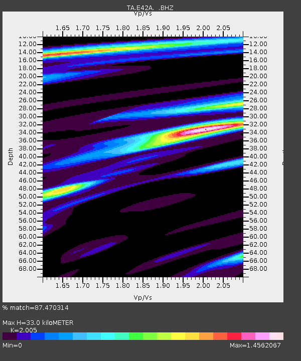
E42A Champion, MI, USA - Earthquake Result Viewer
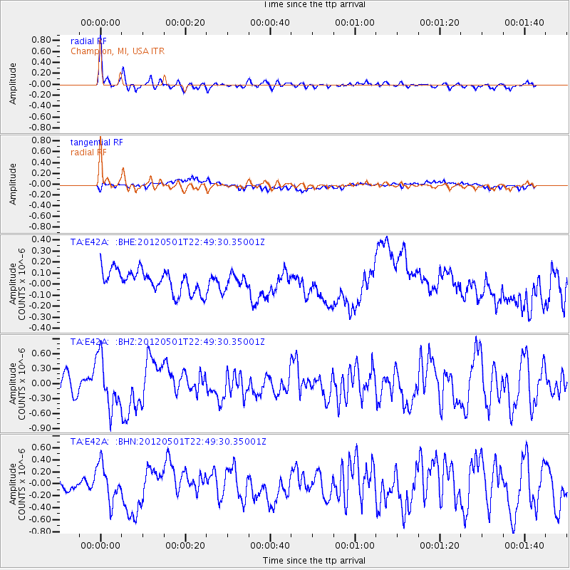
Earthquake location: Near Coast Of Chiapas, Mexico
Earthquake latitude/longitude: 14.4/-92.9
Earthquake time(UTC): 2012/05/01 (122) 22:43:33 GMT
Earthquake Depth: 14 km
Earthquake Magnitude: 5.6 MB, 5.8 MS, 6.0 MW, 5.9 MW
Earthquake Catalog/Contributor: WHDF/NEIC
Network: TA USArray Transportable Network (new EarthScope stations)
Station: E42A Champion, MI, USA
Lat/Lon: 46.43 N/87.91 W
Elevation: 475 m
Distance: 32.2 deg
Az: 6.469 deg
Baz: 189.082 deg
Ray Param: 0.078733414
Estimated Moho Depth: 33.0 km
Estimated Crust Vp/Vs: 2.01
Assumed Crust Vp: 6.472 km/s
Estimated Crust Vs: 3.228 km/s
Estimated Crust Poisson's Ratio: 0.33
Radial Match: 87.470314 %
Radial Bump: 332
Transverse Match: 55.959267 %
Transverse Bump: 400
SOD ConfigId: 446234
Insert Time: 2012-07-28 07:23:54.857 +0000
GWidth: 2.5
Max Bumps: 400
Tol: 0.001

Signal To Noise

ChannelStoNSTALTA
TA:E42A: :BHZ:20120501T22:49:30.35001Z4.1038415.1223395E-71.2481819E-7
TA:E42A: :BHN:20120501T22:49:30.35001Z3.13489943.0780961E-79.818804E-8
TA:E42A: :BHE:20120501T22:49:30.35001Z0.597398165.921365E-89.911924E-8
Arrivals
Ps5.5 SECOND
PpPs14 SECOND
PsPs/PpSs20 SECOND