G43A Wallace, MI, USA - Earthquake Result Viewer
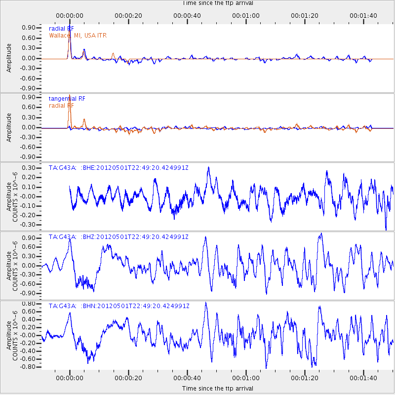
Earthquake location: Near Coast Of Chiapas, Mexico
Earthquake latitude/longitude: 14.4/-92.9
Earthquake time(UTC): 2012/05/01 (122) 22:43:33 GMT
Earthquake Depth: 14 km
Earthquake Magnitude: 5.6 MB, 5.8 MS, 6.0 MW, 5.9 MW
Earthquake Catalog/Contributor: WHDF/NEIC
Network: TA USArray Transportable Network (new EarthScope stations)
Station: G43A Wallace, MI, USA
Lat/Lon: 45.26 N/87.69 W
Elevation: 213 m
Distance: 31.1 deg
Az: 7.135 deg
Baz: 189.812 deg
Ray Param: 0.079154216
Estimated Moho Depth: 46.0 km
Estimated Crust Vp/Vs: 1.65
Assumed Crust Vp: 6.53 km/s
Estimated Crust Vs: 3.946 km/s
Estimated Crust Poisson's Ratio: 0.21
Radial Match: 88.98475 %
Radial Bump: 314
Transverse Match: 48.317394 %
Transverse Bump: 400
SOD ConfigId: 446234
Insert Time: 2012-07-28 07:24:06.080 +0000
GWidth: 2.5
Max Bumps: 400
Tol: 0.001

Signal To Noise

ChannelStoNSTALTA
TA:G43A: :BHZ:20120501T22:49:20.424991Z6.2791645.37585E-78.5614104E-8
TA:G43A: :BHN:20120501T22:49:20.424991Z3.73193453.061515E-78.20356E-8
TA:G43A: :BHE:20120501T22:49:20.424991Z1.66276071.0064599E-76.052945E-8
Arrivals
Ps5.0 SECOND
PpPs17 SECOND
PsPs/PpSs22 SECOND