KOG Kourou, French Guyana - Earthquake Result Viewer
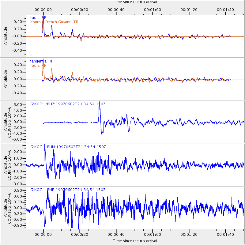
Earthquake location: South Sandwich Islands Region
Earthquake latitude/longitude: -57.8/-25.5
Earthquake time(UTC): 1997/06/02 (153) 21:24:38 GMT
Earthquake Depth: 33 km
Earthquake Magnitude: 5.9 MB, 5.8 MS, 6.1 UNKNOWN, 6.1 MW
Earthquake Catalog/Contributor: WHDF/NEIC
Network: G GEOSCOPE
Station: KOG Kourou, French Guyana
Lat/Lon: 5.21 N/52.73 W
Elevation: 10 m
Distance: 66.5 deg
Az: 330.172 deg
Baz: 164.479 deg
Ray Param: 0.057500083
Estimated Moho Depth: 39.5 km
Estimated Crust Vp/Vs: 1.75
Assumed Crust Vp: 6.472 km/s
Estimated Crust Vs: 3.704 km/s
Estimated Crust Poisson's Ratio: 0.26
Radial Match: 94.05773 %
Radial Bump: 400
Transverse Match: 78.44255 %
Transverse Bump: 400
SOD ConfigId: 6273
Insert Time: 2010-02-26 23:31:55.520 +0000
GWidth: 2.5
Max Bumps: 400
Tol: 0.001

Signal To Noise

ChannelStoNSTALTA
G:KOG: :BHN:19970602T21:34:54.150Z10.5663321.1495551E-61.08794154E-7
G:KOG: :BHE:19970602T21:34:54.150Z3.77257924.510463E-71.1955913E-7
G:KOG: :BHZ:19970602T21:34:54.150Z25.5141492.7728427E-61.0867863E-7
Arrivals
Ps4.8 SECOND
PpPs16 SECOND
PsPs/PpSs21 SECOND