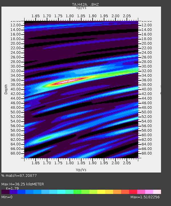
H42A Shiocton, WI, USA - Earthquake Result Viewer
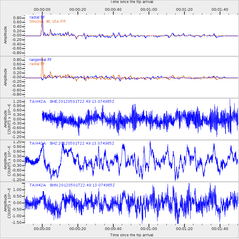
Earthquake location: Near Coast Of Chiapas, Mexico
Earthquake latitude/longitude: 14.4/-92.9
Earthquake time(UTC): 2012/05/01 (122) 22:43:33 GMT
Earthquake Depth: 14 km
Earthquake Magnitude: 5.6 MB, 5.8 MS, 6.0 MW, 5.9 MW
Earthquake Catalog/Contributor: WHDF/NEIC
Network: TA USArray Transportable Network (new EarthScope stations)
Station: H42A Shiocton, WI, USA
Lat/Lon: 44.51 N/88.53 W
Elevation: 244 m
Distance: 30.3 deg
Az: 6.205 deg
Baz: 188.417 deg
Ray Param: 0.07937324
Estimated Moho Depth: 36.25 km
Estimated Crust Vp/Vs: 1.79
Assumed Crust Vp: 6.41 km/s
Estimated Crust Vs: 3.581 km/s
Estimated Crust Poisson's Ratio: 0.27
Radial Match: 87.20877 %
Radial Bump: 400
Transverse Match: 56.576694 %
Transverse Bump: 400
SOD ConfigId: 446234
Insert Time: 2012-07-28 07:24:38.682 +0000
GWidth: 2.5
Max Bumps: 400
Tol: 0.001

Signal To Noise

ChannelStoNSTALTA
TA:H42A: :BHZ:20120501T22:49:13.074985Z4.27857645.8005844E-71.3557278E-7
TA:H42A: :BHN:20120501T22:49:13.074985Z1.64923614.1679544E-72.527203E-7
TA:H42A: :BHE:20120501T22:49:13.074985Z1.26038973.3638267E-72.6688784E-7
Arrivals
Ps4.8 SECOND
PpPs15 SECOND
PsPs/PpSs19 SECOND