
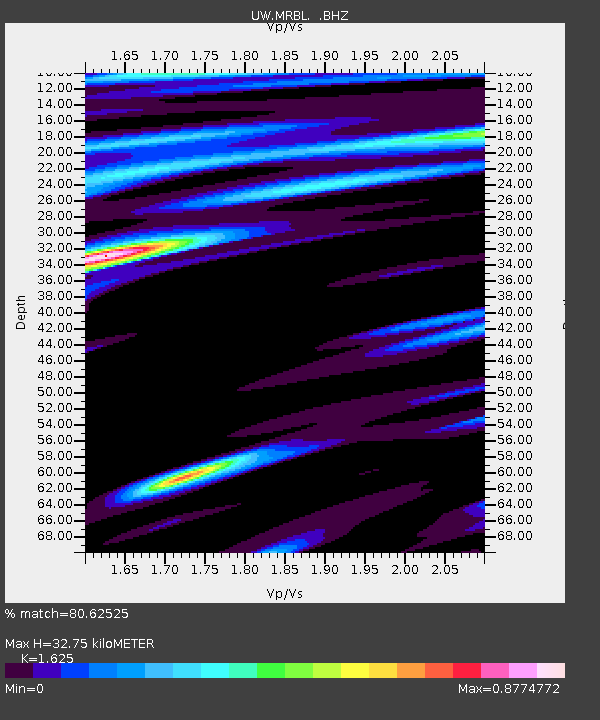
MRBL Marblemount, WA, USA - Earthquake Result Viewer
| ||||||||||||||||||
| ||||||||||||||||||
| ||||||||||||||||||
|
Signal To Noise
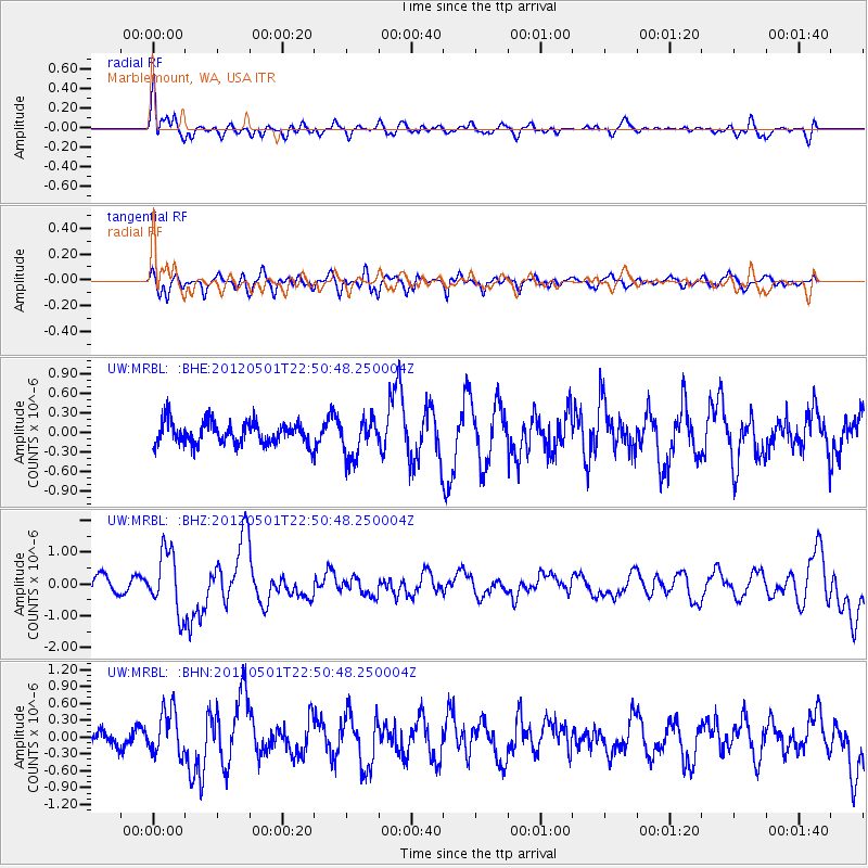
| Channel | StoN | STA | LTA |
| UW:MRBL: :BHZ:20120501T22:50:48.250004Z | 2.6009963 | 9.49508E-7 | 3.6505548E-7 |
| UW:MRBL: :BHN:20120501T22:50:48.250004Z | 2.2903166 | 3.941883E-7 | 1.7211084E-7 |
| UW:MRBL: :BHE:20120501T22:50:48.250004Z | 1.7345378 | 2.949968E-7 | 1.7007228E-7 |
| Arrivals | |
| Ps | 3.4 SECOND |
| PpPs | 12 SECOND |
| PsPs/PpSs | 15 SECOND |

