
KOG Kourou, French Guyana - Earthquake Result Viewer
| ||||||||||||||||||
| ||||||||||||||||||
| ||||||||||||||||||
|
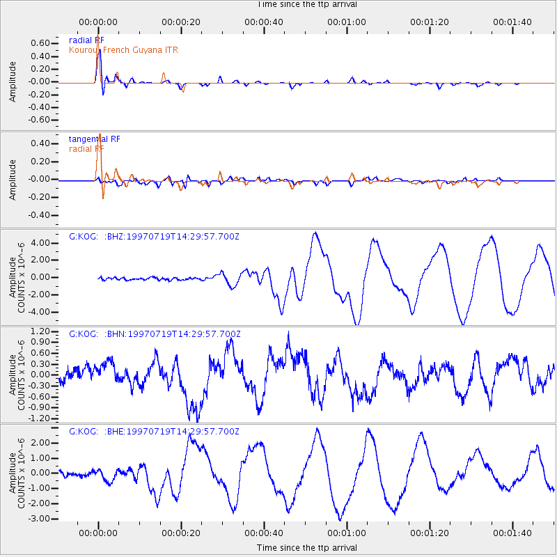
Signal To Noise
| Channel | StoN | STA | LTA |
| G:KOG: :BHN:19970719T14:29:57.700Z | 1.8523715 | 3.5670377E-7 | 1.92566E-7 |
| G:KOG: :BHE:19970719T14:29:57.700Z | 3.5354323 | 4.1566693E-7 | 1.1757174E-7 |
| G:KOG: :BHZ:19970719T14:29:57.700Z | 5.87463 | 7.3050853E-7 | 1.2434971E-7 |
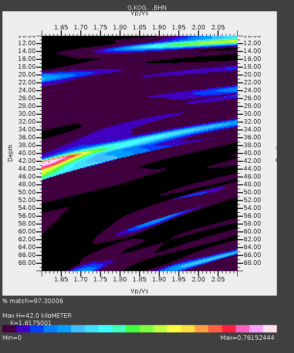
| Arrivals | |
| Ps | 4.3 SECOND |
| PpPs | 16 SECOND |
| PsPs/PpSs | 20 SECOND |

