
KOG Kourou, French Guyana - Earthquake Result Viewer
| ||||||||||||||||||
| ||||||||||||||||||
| ||||||||||||||||||
|
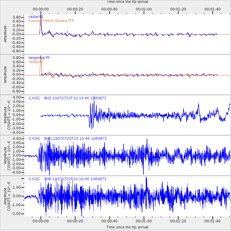
Signal To Noise
| Channel | StoN | STA | LTA |
| G:KOG: :BHN:19970720T10:19:46.198987Z | 18.593084 | 1.9055745E-6 | 1.0248836E-7 |
| G:KOG: :BHE:19970720T10:19:46.198987Z | 7.472974 | 7.6428597E-7 | 1.0227334E-7 |
| G:KOG: :BHZ:19970720T10:19:46.198987Z | 10.943053 | 1.4709711E-6 | 1.3442055E-7 |
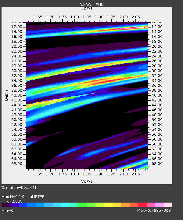
| Arrivals | |
| Ps | 2.2 SECOND |
| PpPs | 5.3 SECOND |
| PsPs/PpSs | 7.5 SECOND |

