You are here: Home > Network List > AZ - ANZA Regional Network Stations List
> Station SMER AZ.SMER > Earthquake Result Viewer
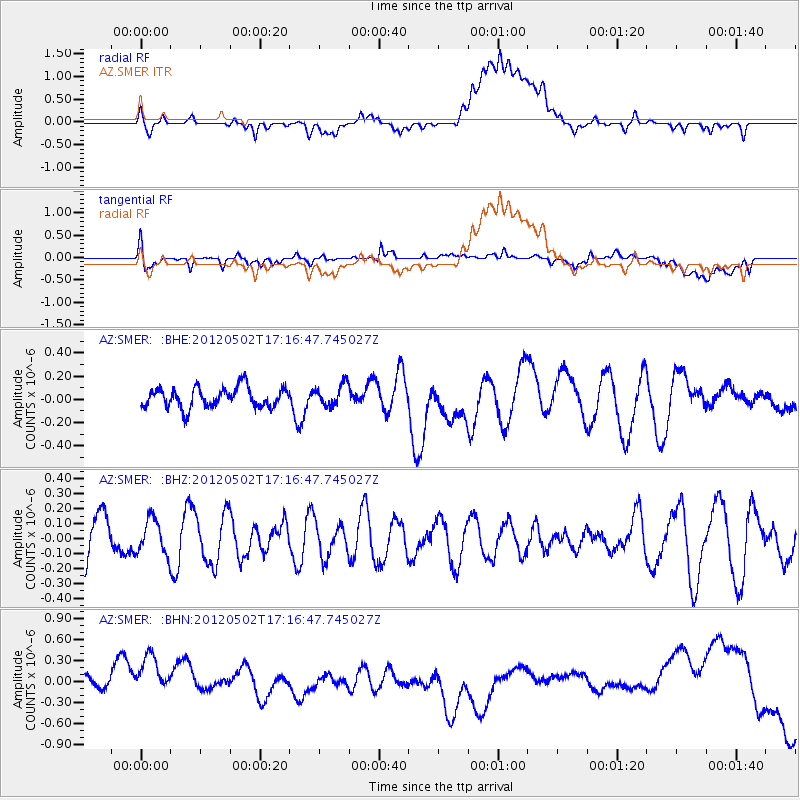
SMER AZ.SMER - Earthquake Result Viewer
*The percent match for this event was below the threshold and hence no stack was calculated.
| Earthquake location: |
Southeast Of Easter Island |
| Earthquake latitude/longitude: |
-35.9/-102.7 |
| Earthquake time(UTC): |
2012/05/02 (123) 17:06:05 GMT |
| Earthquake Depth: |
10 km |
| Earthquake Magnitude: |
5.5 MW, 4.9 MS, 4.7 MB |
| Earthquake Catalog/Contributor: |
WHDF/NEIC |
|
| Network: |
AZ ANZA Regional Network |
| Station: |
SMER AZ.SMER |
| Lat/Lon: |
33.46 N/117.17 W |
| Elevation: |
355 m |
|
| Distance: |
70.3 deg |
| Az: |
347.204 deg |
| Baz: |
167.576 deg |
| Ray Param: |
$rayparam |
*The percent match for this event was below the threshold and hence was not used in the summary stack. |
|
| Radial Match: |
23.227411 % |
| Radial Bump: |
400 |
| Transverse Match: |
39.514553 % |
| Transverse Bump: |
400 |
| SOD ConfigId: |
446234 |
| Insert Time: |
2012-07-28 07:37:15.260 +0000 |
| GWidth: |
2.5 |
| Max Bumps: |
400 |
| Tol: |
0.001 |
|
Signal To Noise
| Channel | StoN | STA | LTA |
| AZ:SMER: :BHZ:20120502T17:16:47.745027Z | 0.8407426 | 1.17343816E-7 | 1.3957164E-7 |
| AZ:SMER: :BHN:20120502T17:16:47.745027Z | 1.4157437 | 5.1687783E-7 | 3.650928E-7 |
| AZ:SMER: :BHE:20120502T17:16:47.745027Z | 1.0543237 | 9.091816E-8 | 8.623363E-8 |
| Arrivals |
| Ps | |
| PpPs | |
| PsPs/PpSs | |


