You are here: Home > Network List > IU - Global Seismograph Network (GSN - IRIS/USGS) Stations List
> Station RSSD Black Hills, South Dakota, USA > Earthquake Result Viewer
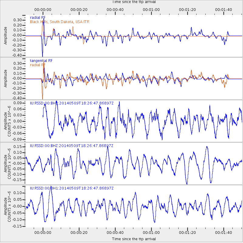
RSSD Black Hills, South Dakota, USA - Earthquake Result Viewer
*The percent match for this event was below the threshold and hence no stack was calculated.
| Earthquake location: |
Tonga Islands Region |
| Earthquake latitude/longitude: |
-23.7/-175.2 |
| Earthquake time(UTC): |
2014/05/09 (129) 18:14:03 GMT |
| Earthquake Depth: |
11 km |
| Earthquake Magnitude: |
5.0 mb |
| Earthquake Catalog/Contributor: |
ISC/ISC |
|
| Network: |
IU Global Seismograph Network (GSN - IRIS/USGS) |
| Station: |
RSSD Black Hills, South Dakota, USA |
| Lat/Lon: |
44.12 N/104.04 W |
| Elevation: |
2090 m |
|
| Distance: |
93.7 deg |
| Az: |
43.084 deg |
| Baz: |
240.398 deg |
| Ray Param: |
$rayparam |
*The percent match for this event was below the threshold and hence was not used in the summary stack. |
|
| Radial Match: |
45.826523 % |
| Radial Bump: |
400 |
| Transverse Match: |
40.223522 % |
| Transverse Bump: |
400 |
| SOD ConfigId: |
3390531 |
| Insert Time: |
2019-04-11 19:09:58.372 +0000 |
| GWidth: |
2.5 |
| Max Bumps: |
400 |
| Tol: |
0.001 |
|
Signal To Noise
| Channel | StoN | STA | LTA |
| IU:RSSD:00:BHZ:20140509T18:26:47.86897Z | 0.5661954 | 4.2383885E-8 | 7.485735E-8 |
| IU:RSSD:00:BH1:20140509T18:26:47.86897Z | 2.9442265 | 9.506111E-8 | 3.2287296E-8 |
| IU:RSSD:00:BH2:20140509T18:26:47.86897Z | 1.0870719 | 4.659915E-8 | 4.286667E-8 |
| Arrivals |
| Ps | |
| PpPs | |
| PsPs/PpSs | |


