You are here: Home > Network List > TA - USArray Transportable Network (new EarthScope stations) Stations List
> Station MSTX Muleshoe, TX, USA > Earthquake Result Viewer
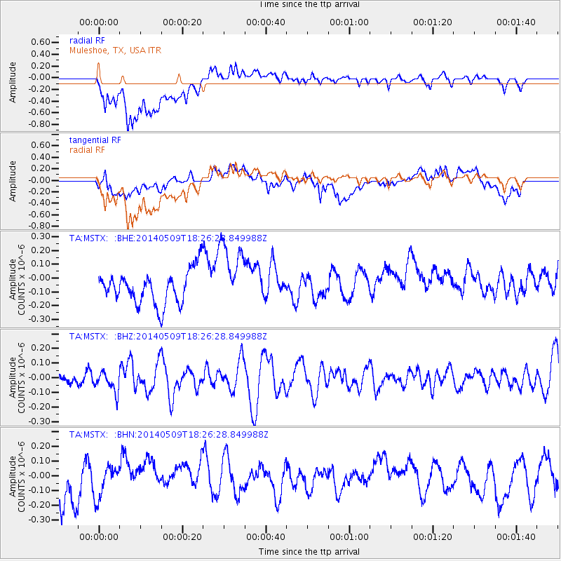
MSTX Muleshoe, TX, USA - Earthquake Result Viewer
*The percent match for this event was below the threshold and hence no stack was calculated.
| Earthquake location: |
Tonga Islands Region |
| Earthquake latitude/longitude: |
-23.7/-175.2 |
| Earthquake time(UTC): |
2014/05/09 (129) 18:14:03 GMT |
| Earthquake Depth: |
11 km |
| Earthquake Magnitude: |
5.0 mb |
| Earthquake Catalog/Contributor: |
ISC/ISC |
|
| Network: |
TA USArray Transportable Network (new EarthScope stations) |
| Station: |
MSTX Muleshoe, TX, USA |
| Lat/Lon: |
33.97 N/102.77 W |
| Elevation: |
1167 m |
|
| Distance: |
89.6 deg |
| Az: |
52.405 deg |
| Baz: |
240.93 deg |
| Ray Param: |
$rayparam |
*The percent match for this event was below the threshold and hence was not used in the summary stack. |
|
| Radial Match: |
63.20529 % |
| Radial Bump: |
400 |
| Transverse Match: |
53.25234 % |
| Transverse Bump: |
400 |
| SOD ConfigId: |
3390531 |
| Insert Time: |
2019-04-11 19:11:18.348 +0000 |
| GWidth: |
2.5 |
| Max Bumps: |
400 |
| Tol: |
0.001 |
|
Signal To Noise
| Channel | StoN | STA | LTA |
| TA:MSTX: :BHZ:20140509T18:26:28.849988Z | 1.0805783 | 6.8591135E-8 | 6.347632E-8 |
| TA:MSTX: :BHN:20140509T18:26:28.849988Z | 0.8646448 | 1.0416718E-7 | 1.2047396E-7 |
| TA:MSTX: :BHE:20140509T18:26:28.849988Z | 2.0012002 | 2.430594E-7 | 1.2145681E-7 |
| Arrivals |
| Ps | |
| PpPs | |
| PsPs/PpSs | |


