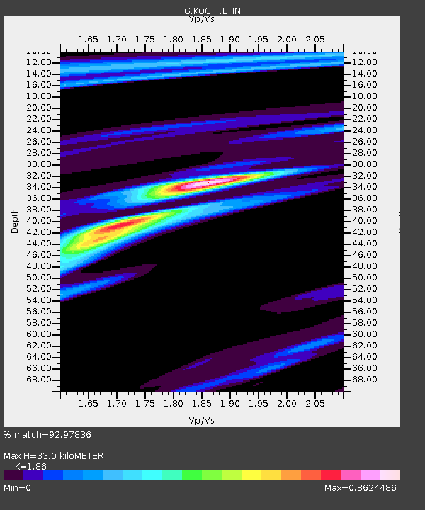
KOG Kourou, French Guyana - Earthquake Result Viewer

Earthquake location: North Of Ascension Island
Earthquake latitude/longitude: -1.3/-14.3
Earthquake time(UTC): 1996/02/18 (049) 23:49:28 GMT
Earthquake Depth: 10 km
Earthquake Magnitude: 6.3 MB, 6.4 MS, 6.6 UNKNOWN, 6.5 MW
Earthquake Catalog/Contributor: WHDF/NEIC
Network: G GEOSCOPE
Station: KOG Kourou, French Guyana
Lat/Lon: 5.21 N/52.73 W
Elevation: 10 m
Distance: 39.0 deg
Az: 279.843 deg
Baz: 98.482 deg
Ray Param: 0.07526523
Estimated Moho Depth: 33.0 km
Estimated Crust Vp/Vs: 1.86
Assumed Crust Vp: 6.472 km/s
Estimated Crust Vs: 3.48 km/s
Estimated Crust Poisson's Ratio: 0.30
Radial Match: 92.97836 %
Radial Bump: 247
Transverse Match: 64.20586 %
Transverse Bump: 400
SOD ConfigId: 4480
Insert Time: 2010-02-26 23:32:20.524 +0000
GWidth: 2.5
Max Bumps: 400
Tol: 0.001

Signal To Noise

ChannelStoNSTALTA
G:KOG: :BHN:19960218T23:56:23.268005Z5.06737957.651052E-71.5098637E-7
G:KOG: :BHE:19960218T23:56:23.268005Z1.04997751.3620726E-71.2972397E-7
G:KOG: :BHZ:19960218T23:56:23.268005Z3.85775524.090798E-71.0604089E-7
Arrivals
Ps4.7 SECOND
PpPs14 SECOND
PsPs/PpSs18 SECOND