KOG Kourou, French Guyana - Earthquake Result Viewer
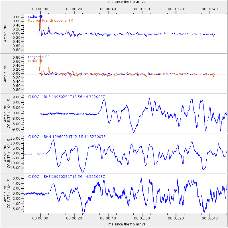
Earthquake location: Off Coast Of Northern Peru
Earthquake latitude/longitude: -9.6/-79.6
Earthquake time(UTC): 1996/02/21 (052) 12:51:04 GMT
Earthquake Depth: 33 km
Earthquake Magnitude: 5.8 MB, 6.6 MS, 7.5 UNKNOWN, 7.3 MW
Earthquake Catalog/Contributor: WHDF/NEIC
Network: G GEOSCOPE
Station: KOG Kourou, French Guyana
Lat/Lon: 5.21 N/52.73 W
Elevation: 10 m
Distance: 30.5 deg
Az: 62.26 deg
Baz: 241.206 deg
Ray Param: 0.07927709
Estimated Moho Depth: 42.25 km
Estimated Crust Vp/Vs: 1.72
Assumed Crust Vp: 6.472 km/s
Estimated Crust Vs: 3.768 km/s
Estimated Crust Poisson's Ratio: 0.24
Radial Match: 96.08588 %
Radial Bump: 335
Transverse Match: 68.661316 %
Transverse Bump: 400
SOD ConfigId: 4480
Insert Time: 2010-02-26 23:32:25.831 +0000
GWidth: 2.5
Max Bumps: 400
Tol: 0.001

Signal To Noise

ChannelStoNSTALTA
G:KOG: :BHN:19960221T12:56:44.322003Z3.31708226.940586E-72.0923768E-7
G:KOG: :BHE:19960221T12:56:44.322003Z0.5770752.1000814E-73.6391828E-7
G:KOG: :BHZ:19960221T12:56:44.322003Z1.74195773.635143E-72.0868148E-7
Arrivals
Ps5.1 SECOND
PpPs16 SECOND
PsPs/PpSs21 SECOND