You are here: Home > Network List > TA - USArray Transportable Network (new EarthScope stations) Stations List
> Station A32A Rocking H Ranch, Lancaster, MN, USA > Earthquake Result Viewer
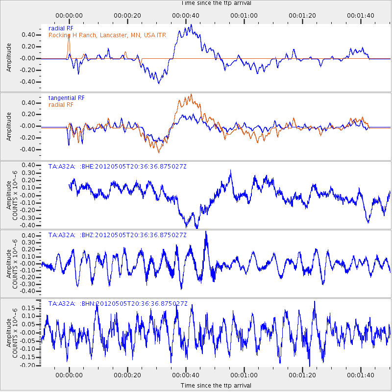
A32A Rocking H Ranch, Lancaster, MN, USA - Earthquake Result Viewer
*The percent match for this event was below the threshold and hence no stack was calculated.
| Earthquake location: |
Tonga Islands |
| Earthquake latitude/longitude: |
-21.5/-174.2 |
| Earthquake time(UTC): |
2012/05/05 (126) 20:23:31 GMT |
| Earthquake Depth: |
8.5 km |
| Earthquake Magnitude: |
5.6 MS, 5.7 MW, 5.6 MW |
| Earthquake Catalog/Contributor: |
WHDF/NEIC |
|
| Network: |
TA USArray Transportable Network (new EarthScope stations) |
| Station: |
A32A Rocking H Ranch, Lancaster, MN, USA |
| Lat/Lon: |
48.92 N/96.49 W |
| Elevation: |
322 m |
|
| Distance: |
98.2 deg |
| Az: |
40.639 deg |
| Baz: |
246.866 deg |
| Ray Param: |
$rayparam |
*The percent match for this event was below the threshold and hence was not used in the summary stack. |
|
| Radial Match: |
41.53875 % |
| Radial Bump: |
400 |
| Transverse Match: |
51.20035 % |
| Transverse Bump: |
400 |
| SOD ConfigId: |
446234 |
| Insert Time: |
2012-07-28 08:28:09.139 +0000 |
| GWidth: |
2.5 |
| Max Bumps: |
400 |
| Tol: |
0.001 |
|
Signal To Noise
| Channel | StoN | STA | LTA |
| TA:A32A: :BHZ:20120505T20:36:36.875027Z | 1.2777584 | 1.5224487E-7 | 1.19149966E-7 |
| TA:A32A: :BHN:20120505T20:36:36.875027Z | 1.320078 | 6.191476E-8 | 4.690235E-8 |
| TA:A32A: :BHE:20120505T20:36:36.875027Z | 1.6212 | 9.835863E-8 | 6.067027E-8 |
| Arrivals |
| Ps | |
| PpPs | |
| PsPs/PpSs | |


