You are here: Home > Network List > IW - Intermountain West Stations List
> Station MOOW Moose Ponds, Wyoming, USA > Earthquake Result Viewer
MOOW Moose Ponds, Wyoming, USA - Earthquake Result Viewer
*The percent match for this event was below the threshold and hence no stack was calculated.
| Earthquake location: |
Eastern Caucasus |
| Earthquake latitude/longitude: |
41.5/46.8 |
| Earthquake time(UTC): |
2012/05/07 (128) 04:40:27 GMT |
| Earthquake Depth: |
11 km |
| Earthquake Magnitude: |
5.7 MB, 5.7 MS, 5.6 MW, 5.6 MW |
| Earthquake Catalog/Contributor: |
WHDF/NEIC |
|
| Network: |
IW Intermountain West |
| Station: |
MOOW Moose Ponds, Wyoming, USA |
| Lat/Lon: |
43.75 N/110.74 W |
| Elevation: |
2128 m |
|
| Distance: |
92.7 deg |
| Az: |
343.904 deg |
| Baz: |
16.688 deg |
| Ray Param: |
$rayparam |
*The percent match for this event was below the threshold and hence was not used in the summary stack. |
|
| Radial Match: |
68.25576 % |
| Radial Bump: |
400 |
| Transverse Match: |
60.027496 % |
| Transverse Bump: |
400 |
| SOD ConfigId: |
446234 |
| Insert Time: |
2012-08-05 04:11:27.540 +0000 |
| GWidth: |
2.5 |
| Max Bumps: |
400 |
| Tol: |
0.001 |
|
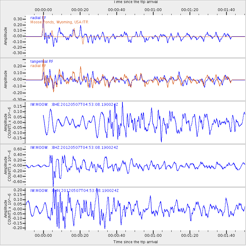
Signal To Noise
| Channel | StoN | STA | LTA |
| IW:MOOW: :BHZ:20120507T04:53:08.190024Z | 3.6321602 | 1.5016103E-7 | 4.1342073E-8 |
| IW:MOOW: :BHN:20120507T04:53:08.190024Z | 1.0758189 | 5.8187368E-8 | 5.4086584E-8 |
| IW:MOOW: :BHE:20120507T04:53:08.190024Z | 1.8402706 | 9.102374E-8 | 4.946215E-8 |
| Arrivals |
| Ps | |
| PpPs | |
| PsPs/PpSs | |


