You are here: Home > Network List > US - United States National Seismic Network Stations List
> Station MSO Missoula, Montana, USA > Earthquake Result Viewer
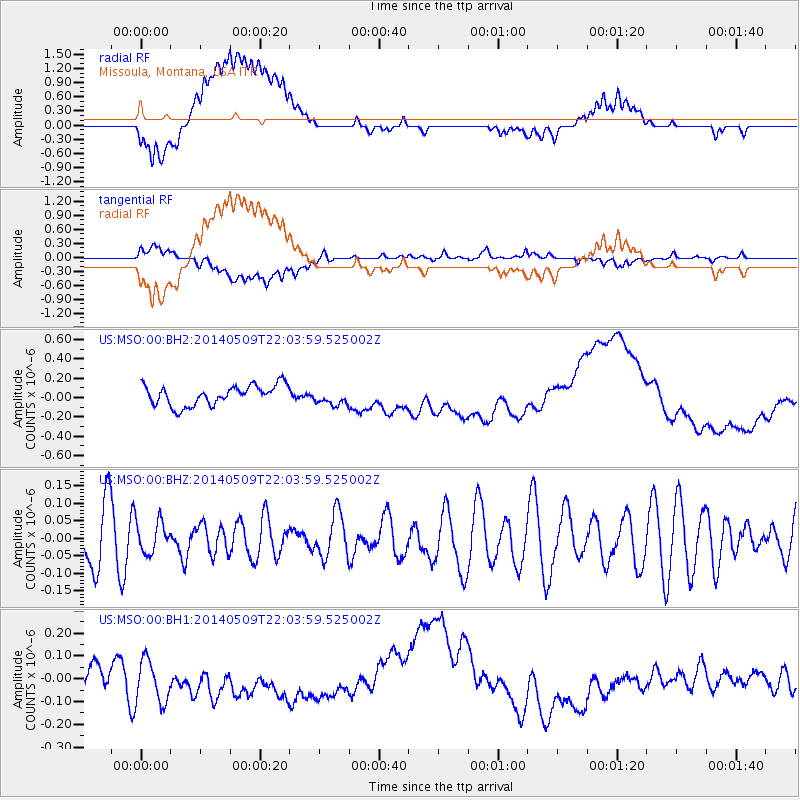
MSO Missoula, Montana, USA - Earthquake Result Viewer
*The percent match for this event was below the threshold and hence no stack was calculated.
| Earthquake location: |
Solomon Islands |
| Earthquake latitude/longitude: |
-7.0/154.9 |
| Earthquake time(UTC): |
2014/05/09 (129) 21:51:08 GMT |
| Earthquake Depth: |
41 km |
| Earthquake Magnitude: |
5.2 MW |
| Earthquake Catalog/Contributor: |
ISC/ISC |
|
| Network: |
US United States National Seismic Network |
| Station: |
MSO Missoula, Montana, USA |
| Lat/Lon: |
46.83 N/113.94 W |
| Elevation: |
1264 m |
|
| Distance: |
95.8 deg |
| Az: |
43.632 deg |
| Baz: |
266.048 deg |
| Ray Param: |
$rayparam |
*The percent match for this event was below the threshold and hence was not used in the summary stack. |
|
| Radial Match: |
25.673264 % |
| Radial Bump: |
400 |
| Transverse Match: |
31.621204 % |
| Transverse Bump: |
400 |
| SOD ConfigId: |
3390531 |
| Insert Time: |
2019-04-11 19:16:52.936 +0000 |
| GWidth: |
2.5 |
| Max Bumps: |
400 |
| Tol: |
0.001 |
|
Signal To Noise
| Channel | StoN | STA | LTA |
| US:MSO:00:BHZ:20140509T22:03:59.525002Z | 0.55884415 | 4.340808E-8 | 7.7674756E-8 |
| US:MSO:00:BH1:20140509T22:03:59.525002Z | 2.1298869 | 9.6210606E-8 | 4.5171696E-8 |
| US:MSO:00:BH2:20140509T22:03:59.525002Z | 0.80001056 | 8.210325E-8 | 1.0262771E-7 |
| Arrivals |
| Ps | |
| PpPs | |
| PsPs/PpSs | |


