You are here: Home > Network List > TA - USArray Transportable Network (new EarthScope stations) Stations List
> Station C37A Embarrass, MN, USA > Earthquake Result Viewer
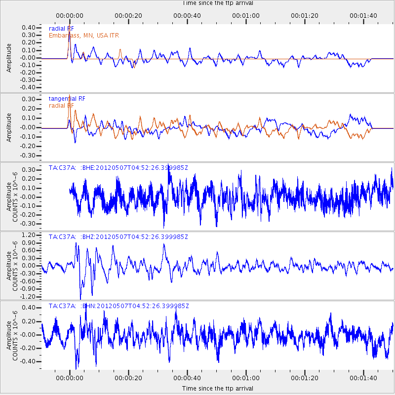
C37A Embarrass, MN, USA - Earthquake Result Viewer
*The percent match for this event was below the threshold and hence no stack was calculated.
| Earthquake location: |
Eastern Caucasus |
| Earthquake latitude/longitude: |
41.5/46.8 |
| Earthquake time(UTC): |
2012/05/07 (128) 04:40:27 GMT |
| Earthquake Depth: |
11 km |
| Earthquake Magnitude: |
5.7 MB, 5.7 MS, 5.6 MW, 5.6 MW |
| Earthquake Catalog/Contributor: |
WHDF/NEIC |
|
| Network: |
TA USArray Transportable Network (new EarthScope stations) |
| Station: |
C37A Embarrass, MN, USA |
| Lat/Lon: |
47.73 N/92.19 W |
| Elevation: |
447 m |
|
| Distance: |
84.0 deg |
| Az: |
333.537 deg |
| Baz: |
29.698 deg |
| Ray Param: |
$rayparam |
*The percent match for this event was below the threshold and hence was not used in the summary stack. |
|
| Radial Match: |
66.49973 % |
| Radial Bump: |
400 |
| Transverse Match: |
62.31262 % |
| Transverse Bump: |
400 |
| SOD ConfigId: |
446234 |
| Insert Time: |
2012-08-05 04:20:33.599 +0000 |
| GWidth: |
2.5 |
| Max Bumps: |
400 |
| Tol: |
0.001 |
|
Signal To Noise
| Channel | StoN | STA | LTA |
| TA:C37A: :BHZ:20120507T04:52:26.399985Z | 6.573625 | 5.3901385E-7 | 8.199643E-8 |
| TA:C37A: :BHN:20120507T04:52:26.399985Z | 2.0512764 | 1.8685334E-7 | 9.109125E-8 |
| TA:C37A: :BHE:20120507T04:52:26.399985Z | 1.5126128 | 1.445587E-7 | 9.5568865E-8 |
| Arrivals |
| Ps | |
| PpPs | |
| PsPs/PpSs | |


