You are here: Home > Network List > UW - Pacific Northwest Regional Seismic Network Stations List
> Station MRBL Marblemount, WA, USA > Earthquake Result Viewer
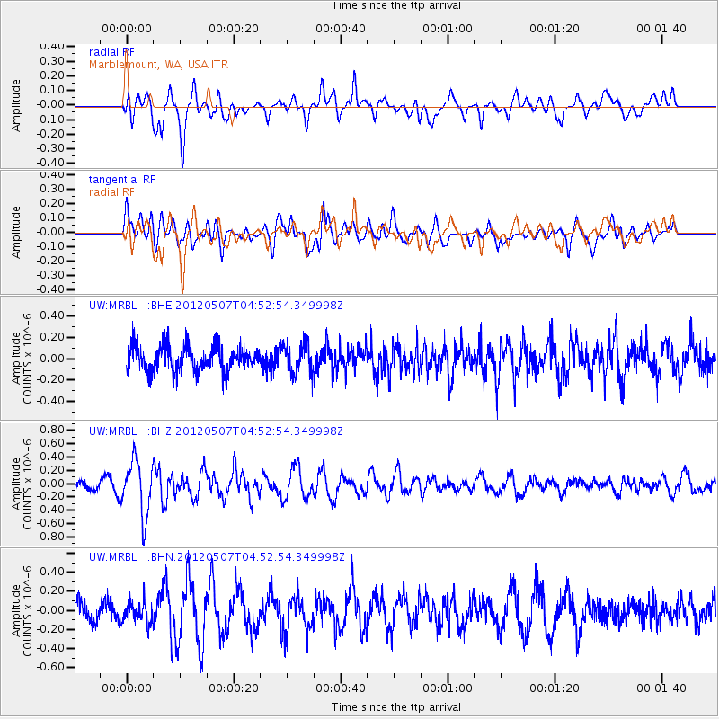
MRBL Marblemount, WA, USA - Earthquake Result Viewer
*The percent match for this event was below the threshold and hence no stack was calculated.
| Earthquake location: |
Eastern Caucasus |
| Earthquake latitude/longitude: |
41.5/46.8 |
| Earthquake time(UTC): |
2012/05/07 (128) 04:40:27 GMT |
| Earthquake Depth: |
11 km |
| Earthquake Magnitude: |
5.7 MB, 5.7 MS, 5.6 MW, 5.6 MW |
| Earthquake Catalog/Contributor: |
WHDF/NEIC |
|
| Network: |
UW Pacific Northwest Regional Seismic Network |
| Station: |
MRBL Marblemount, WA, USA |
| Lat/Lon: |
48.52 N/121.48 W |
| Elevation: |
75 m |
|
| Distance: |
89.7 deg |
| Az: |
352.234 deg |
| Baz: |
8.775 deg |
| Ray Param: |
$rayparam |
*The percent match for this event was below the threshold and hence was not used in the summary stack. |
|
| Radial Match: |
73.63012 % |
| Radial Bump: |
400 |
| Transverse Match: |
64.701996 % |
| Transverse Bump: |
400 |
| SOD ConfigId: |
446234 |
| Insert Time: |
2012-08-05 04:34:17.042 +0000 |
| GWidth: |
2.5 |
| Max Bumps: |
400 |
| Tol: |
0.001 |
|
Signal To Noise
| Channel | StoN | STA | LTA |
| UW:MRBL: :BHZ:20120507T04:52:54.349998Z | 5.1748967 | 4.0505552E-7 | 7.827316E-8 |
| UW:MRBL: :BHN:20120507T04:52:54.349998Z | 1.0176171 | 1.06919025E-7 | 1.0506803E-7 |
| UW:MRBL: :BHE:20120507T04:52:54.349998Z | 1.2172381 | 1.3984719E-7 | 1.1488893E-7 |
| Arrivals |
| Ps | |
| PpPs | |
| PsPs/PpSs | |


