You are here: Home > Network List > TA - USArray Transportable Network (new EarthScope stations) Stations List
> Station I32A Karley and Nick, Howard, SD, USA > Earthquake Result Viewer
I32A Karley and Nick, Howard, SD, USA - Earthquake Result Viewer
*The percent match for this event was below the threshold and hence no stack was calculated.
| Earthquake location: |
Eastern Caucasus |
| Earthquake latitude/longitude: |
41.6/46.7 |
| Earthquake time(UTC): |
2012/05/07 (128) 14:15:14 GMT |
| Earthquake Depth: |
12 km |
| Earthquake Magnitude: |
5.6 MB, 5.0 MS, 5.3 MW, 5.4 MW |
| Earthquake Catalog/Contributor: |
WHDF/NEIC |
|
| Network: |
TA USArray Transportable Network (new EarthScope stations) |
| Station: |
I32A Karley and Nick, Howard, SD, USA |
| Lat/Lon: |
44.03 N/97.46 W |
| Elevation: |
493 m |
|
| Distance: |
88.9 deg |
| Az: |
335.027 deg |
| Baz: |
26.059 deg |
| Ray Param: |
$rayparam |
*The percent match for this event was below the threshold and hence was not used in the summary stack. |
|
| Radial Match: |
64.76204 % |
| Radial Bump: |
400 |
| Transverse Match: |
56.56113 % |
| Transverse Bump: |
400 |
| SOD ConfigId: |
446234 |
| Insert Time: |
2012-08-05 04:53:01.952 +0000 |
| GWidth: |
2.5 |
| Max Bumps: |
400 |
| Tol: |
0.001 |
|
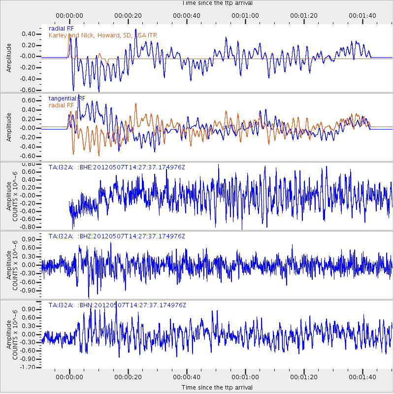
Signal To Noise
| Channel | StoN | STA | LTA |
| TA:I32A: :BHZ:20120507T14:27:37.174976Z | 2.0362897 | 3.2997175E-7 | 1.620456E-7 |
| TA:I32A: :BHN:20120507T14:27:37.174976Z | 1.4997845 | 2.94948E-7 | 1.9666027E-7 |
| TA:I32A: :BHE:20120507T14:27:37.174976Z | 1.0269039 | 2.562677E-7 | 2.4955372E-7 |
| Arrivals |
| Ps | |
| PpPs | |
| PsPs/PpSs | |


