You are here: Home > Network List > TA - USArray Transportable Network (new EarthScope stations) Stations List
> Station H31A Wolsey, SD, USA > Earthquake Result Viewer
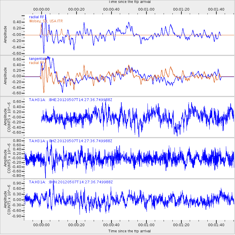
H31A Wolsey, SD, USA - Earthquake Result Viewer
*The percent match for this event was below the threshold and hence no stack was calculated.
| Earthquake location: |
Eastern Caucasus |
| Earthquake latitude/longitude: |
41.6/46.7 |
| Earthquake time(UTC): |
2012/05/07 (128) 14:15:14 GMT |
| Earthquake Depth: |
12 km |
| Earthquake Magnitude: |
5.6 MB, 5.0 MS, 5.3 MW, 5.4 MW |
| Earthquake Catalog/Contributor: |
WHDF/NEIC |
|
| Network: |
TA USArray Transportable Network (new EarthScope stations) |
| Station: |
H31A Wolsey, SD, USA |
| Lat/Lon: |
44.48 N/98.48 W |
| Elevation: |
415 m |
|
| Distance: |
88.8 deg |
| Az: |
335.879 deg |
| Baz: |
25.371 deg |
| Ray Param: |
$rayparam |
*The percent match for this event was below the threshold and hence was not used in the summary stack. |
|
| Radial Match: |
62.61621 % |
| Radial Bump: |
400 |
| Transverse Match: |
79.11126 % |
| Transverse Bump: |
400 |
| SOD ConfigId: |
446234 |
| Insert Time: |
2012-08-05 04:54:13.287 +0000 |
| GWidth: |
2.5 |
| Max Bumps: |
400 |
| Tol: |
0.001 |
|
Signal To Noise
| Channel | StoN | STA | LTA |
| TA:H31A: :BHZ:20120507T14:27:36.749988Z | 2.0732002 | 3.1689106E-7 | 1.5285116E-7 |
| TA:H31A: :BHN:20120507T14:27:36.749988Z | 1.7398956 | 2.924702E-7 | 1.680964E-7 |
| TA:H31A: :BHE:20120507T14:27:36.749988Z | 1.9354357 | 2.626937E-7 | 1.3572846E-7 |
| Arrivals |
| Ps | |
| PpPs | |
| PsPs/PpSs | |


