You are here: Home > Network List > TA - USArray Transportable Network (new EarthScope stations) Stations List
> Station Q41A Truxton, MO, USA > Earthquake Result Viewer
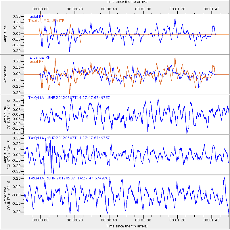
Q41A Truxton, MO, USA - Earthquake Result Viewer
*The percent match for this event was below the threshold and hence no stack was calculated.
| Earthquake location: |
Eastern Caucasus |
| Earthquake latitude/longitude: |
41.6/46.7 |
| Earthquake time(UTC): |
2012/05/07 (128) 14:15:14 GMT |
| Earthquake Depth: |
12 km |
| Earthquake Magnitude: |
5.6 MB, 5.0 MS, 5.3 MW, 5.4 MW |
| Earthquake Catalog/Contributor: |
WHDF/NEIC |
|
| Network: |
TA USArray Transportable Network (new EarthScope stations) |
| Station: |
Q41A Truxton, MO, USA |
| Lat/Lon: |
38.95 N/91.23 W |
| Elevation: |
191 m |
|
| Distance: |
91.2 deg |
| Az: |
328.511 deg |
| Baz: |
30.186 deg |
| Ray Param: |
$rayparam |
*The percent match for this event was below the threshold and hence was not used in the summary stack. |
|
| Radial Match: |
65.42066 % |
| Radial Bump: |
400 |
| Transverse Match: |
55.29754 % |
| Transverse Bump: |
400 |
| SOD ConfigId: |
446234 |
| Insert Time: |
2012-08-05 05:00:54.023 +0000 |
| GWidth: |
2.5 |
| Max Bumps: |
400 |
| Tol: |
0.001 |
|
Signal To Noise
| Channel | StoN | STA | LTA |
| TA:Q41A: :BHZ:20120507T14:27:47.674976Z | 2.0554307 | 1.4996493E-7 | 7.296035E-8 |
| TA:Q41A: :BHN:20120507T14:27:47.674976Z | 0.84392226 | 6.7562965E-8 | 8.0058285E-8 |
| TA:Q41A: :BHE:20120507T14:27:47.674976Z | 1.4620695 | 9.012433E-8 | 6.1641614E-8 |
| Arrivals |
| Ps | |
| PpPs | |
| PsPs/PpSs | |


