MPG Montagne des Peres, French Guyana - Earthquake Result Viewer
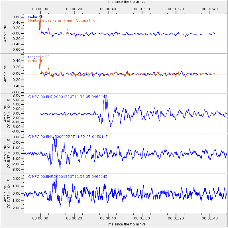
Earthquake location: Off Coast Of Central Chile
Earthquake latitude/longitude: -39.0/-74.7
Earthquake time(UTC): 2000/12/20 (355) 11:23:54 GMT
Earthquake Depth: 11 km
Earthquake Magnitude: 6.1 MB, 6.2 MS, 6.4 MW, 6.0 ME
Earthquake Catalog/Contributor: WHDF/NEIC
Network: G GEOSCOPE
Station: MPG Montagne des Peres, French Guyana
Lat/Lon: 5.11 N/52.64 W
Elevation: 147 m
Distance: 48.4 deg
Az: 29.961 deg
Baz: 202.994 deg
Ray Param: 0.06938834
Estimated Moho Depth: 40.5 km
Estimated Crust Vp/Vs: 1.75
Assumed Crust Vp: 6.472 km/s
Estimated Crust Vs: 3.709 km/s
Estimated Crust Poisson's Ratio: 0.26
Radial Match: 91.42203 %
Radial Bump: 400
Transverse Match: 75.79213 %
Transverse Bump: 400
SOD ConfigId: 20082
Insert Time: 2010-02-26 23:33:18.212 +0000
GWidth: 2.5
Max Bumps: 400
Tol: 0.001

Signal To Noise

ChannelStoNSTALTA
G:MPG:00:BHN:20001220T11:32:05.046014Z1.8907373.328934E-71.760654E-7
G:MPG:00:BHE:20001220T11:32:05.046014Z1.36914633.3268583E-72.429878E-7
G:MPG:00:BHZ:20001220T11:32:05.046014Z2.37304696.6123465E-72.7864374E-7
Arrivals
Ps5.0 SECOND
PpPs16 SECOND
PsPs/PpSs21 SECOND