You are here: Home > Network List > TA - USArray Transportable Network (new EarthScope stations) Stations List
> Station D36A Goodland, MN, USA > Earthquake Result Viewer
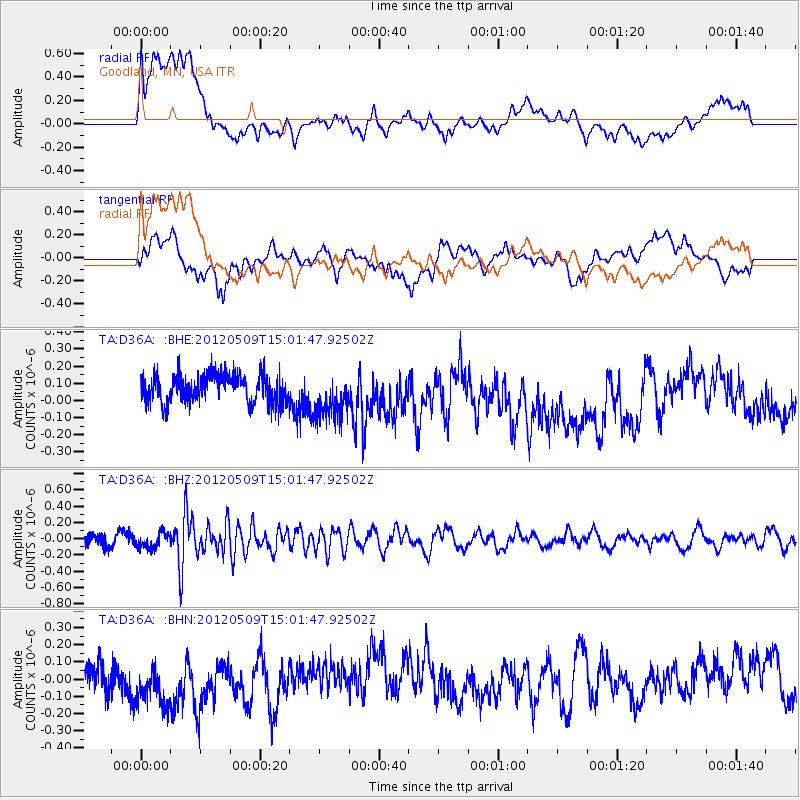
D36A Goodland, MN, USA - Earthquake Result Viewer
*The percent match for this event was below the threshold and hence no stack was calculated.
| Earthquake location: |
North Of Ascension Island |
| Earthquake latitude/longitude: |
-1.0/-13.6 |
| Earthquake time(UTC): |
2012/05/09 (130) 14:49:51 GMT |
| Earthquake Depth: |
12 km |
| Earthquake Magnitude: |
5.5 MW, 5.0 MS, 5.4 MB, 5.6 MW |
| Earthquake Catalog/Contributor: |
WHDF/NEIC |
|
| Network: |
TA USArray Transportable Network (new EarthScope stations) |
| Station: |
D36A Goodland, MN, USA |
| Lat/Lon: |
47.18 N/93.16 W |
| Elevation: |
434 m |
|
| Distance: |
83.6 deg |
| Az: |
317.538 deg |
| Baz: |
98.322 deg |
| Ray Param: |
$rayparam |
*The percent match for this event was below the threshold and hence was not used in the summary stack. |
|
| Radial Match: |
51.180798 % |
| Radial Bump: |
400 |
| Transverse Match: |
46.82532 % |
| Transverse Bump: |
400 |
| SOD ConfigId: |
446234 |
| Insert Time: |
2012-08-05 05:19:02.314 +0000 |
| GWidth: |
2.5 |
| Max Bumps: |
400 |
| Tol: |
0.001 |
|
Signal To Noise
| Channel | StoN | STA | LTA |
| TA:D36A: :BHZ:20120509T15:01:47.92502Z | 1.7393308 | 9.119758E-8 | 5.243257E-8 |
| TA:D36A: :BHN:20120509T15:01:47.92502Z | 1.774541 | 1.5540432E-7 | 8.757438E-8 |
| TA:D36A: :BHE:20120509T15:01:47.92502Z | 1.7015446 | 1.3615374E-7 | 8.0017735E-8 |
| Arrivals |
| Ps | |
| PpPs | |
| PsPs/PpSs | |


