You are here: Home > Network List > TA - USArray Transportable Network (new EarthScope stations) Stations List
> Station E62A Clayton Lake, ME, USA > Earthquake Result Viewer
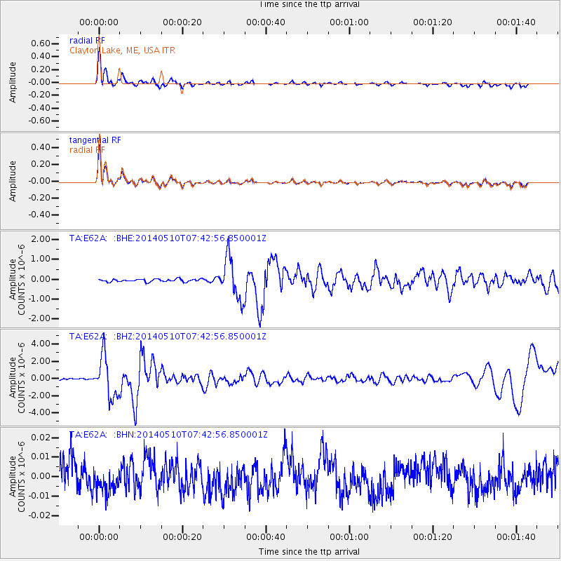
E62A Clayton Lake, ME, USA - Earthquake Result Viewer
*The percent match for this event was below the threshold and hence no stack was calculated.
| Earthquake location: |
Guerrero, Mexico |
| Earthquake latitude/longitude: |
17.3/-100.8 |
| Earthquake time(UTC): |
2014/05/10 (130) 07:36:03 GMT |
| Earthquake Depth: |
35 km |
| Earthquake Magnitude: |
6.0 MB |
| Earthquake Catalog/Contributor: |
NEIC PDE/NEIC COMCAT |
|
| Network: |
TA USArray Transportable Network (new EarthScope stations) |
| Station: |
E62A Clayton Lake, ME, USA |
| Lat/Lon: |
46.62 N/69.52 W |
| Elevation: |
356 m |
|
| Distance: |
39.0 deg |
| Az: |
34.58 deg |
| Baz: |
231.886 deg |
| Ray Param: |
$rayparam |
*The percent match for this event was below the threshold and hence was not used in the summary stack. |
|
| Radial Match: |
92.57588 % |
| Radial Bump: |
400 |
| Transverse Match: |
92.38987 % |
| Transverse Bump: |
400 |
| SOD ConfigId: |
3390531 |
| Insert Time: |
2019-04-11 19:23:59.332 +0000 |
| GWidth: |
2.5 |
| Max Bumps: |
400 |
| Tol: |
0.001 |
|
Signal To Noise
| Channel | StoN | STA | LTA |
| TA:E62A: :BHZ:20140510T07:42:56.850001Z | 27.304247 | 2.4502122E-6 | 8.97374E-8 |
| TA:E62A: :BHN:20140510T07:42:56.850001Z | 0.829247 | 6.329969E-9 | 7.6333935E-9 |
| TA:E62A: :BHE:20140510T07:42:56.850001Z | 15.3015585 | 1.0512238E-6 | 6.870044E-8 |
| Arrivals |
| Ps | |
| PpPs | |
| PsPs/PpSs | |


