You are here: Home > Network List > TA - USArray Transportable Network (new EarthScope stations) Stations List
> Station O56A Blue Knob State Park, Imler, PA, USA > Earthquake Result Viewer
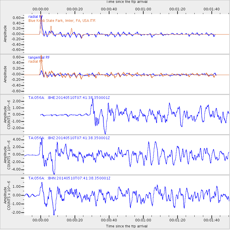
O56A Blue Knob State Park, Imler, PA, USA - Earthquake Result Viewer

| Earthquake location: |
Guerrero, Mexico |
| Earthquake latitude/longitude: |
17.3/-100.8 |
| Earthquake time(UTC): |
2014/05/10 (130) 07:36:03 GMT |
| Earthquake Depth: |
35 km |
| Earthquake Magnitude: |
6.0 MB |
| Earthquake Catalog/Contributor: |
NEIC PDE/NEIC COMCAT |
|
| Network: |
TA USArray Transportable Network (new EarthScope stations) |
| Station: |
O56A Blue Knob State Park, Imler, PA, USA |
| Lat/Lon: |
40.27 N/78.57 W |
| Elevation: |
684 m |
|
| Distance: |
29.9 deg |
| Az: |
35.425 deg |
| Baz: |
226.372 deg |
| Ray Param: |
0.0794391 |
| Estimated Moho Depth: |
47.75 km |
| Estimated Crust Vp/Vs: |
1.60 |
| Assumed Crust Vp: |
6.121 km/s |
| Estimated Crust Vs: |
3.825 km/s |
| Estimated Crust Poisson's Ratio: |
0.18 |
|
| Radial Match: |
94.15992 % |
| Radial Bump: |
400 |
| Transverse Match: |
68.567345 % |
| Transverse Bump: |
400 |
| SOD ConfigId: |
3390531 |
| Insert Time: |
2019-04-11 19:24:15.278 +0000 |
| GWidth: |
2.5 |
| Max Bumps: |
400 |
| Tol: |
0.001 |
|
Signal To Noise
| Channel | StoN | STA | LTA |
| TA:O56A: :BHZ:20140510T07:41:38.350001Z | 26.50821 | 2.1412852E-6 | 8.07782E-8 |
| TA:O56A: :BHN:20140510T07:41:38.350001Z | 10.557756 | 8.273133E-7 | 7.8360706E-8 |
| TA:O56A: :BHE:20140510T07:41:38.350001Z | 18.641396 | 1.1408875E-6 | 6.120183E-8 |
| Arrivals |
| Ps | 5.1 SECOND |
| PpPs | 19 SECOND |
| PsPs/PpSs | 24 SECOND |


