You are here: Home > Network List > TA - USArray Transportable Network (new EarthScope stations) Stations List
> Station K36A Gilmore City, IA, USA > Earthquake Result Viewer
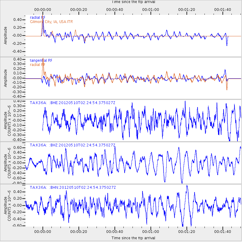
K36A Gilmore City, IA, USA - Earthquake Result Viewer
*The percent match for this event was below the threshold and hence no stack was calculated.
| Earthquake location: |
Easter Island Region |
| Earthquake latitude/longitude: |
-28.7/-112.6 |
| Earthquake time(UTC): |
2012/05/10 (131) 02:13:56 GMT |
| Earthquake Depth: |
10 km |
| Earthquake Magnitude: |
5.8 MS, 5.3 MB, 5.9 MW, 5.8 MW |
| Earthquake Catalog/Contributor: |
WHDF/NEIC |
|
| Network: |
TA USArray Transportable Network (new EarthScope stations) |
| Station: |
K36A Gilmore City, IA, USA |
| Lat/Lon: |
42.64 N/94.45 W |
| Elevation: |
364 m |
|
| Distance: |
73.0 deg |
| Az: |
13.901 deg |
| Baz: |
196.615 deg |
| Ray Param: |
$rayparam |
*The percent match for this event was below the threshold and hence was not used in the summary stack. |
|
| Radial Match: |
62.357872 % |
| Radial Bump: |
400 |
| Transverse Match: |
43.96011 % |
| Transverse Bump: |
400 |
| SOD ConfigId: |
446234 |
| Insert Time: |
2012-08-05 05:34:54.166 +0000 |
| GWidth: |
2.5 |
| Max Bumps: |
400 |
| Tol: |
0.001 |
|
Signal To Noise
| Channel | StoN | STA | LTA |
| TA:K36A: :BHZ:20120510T02:24:54.375027Z | 1.9614238 | 2.520827E-7 | 1.2852027E-7 |
| TA:K36A: :BHN:20120510T02:24:54.375027Z | 1.6398212 | 1.5917793E-7 | 9.707029E-8 |
| TA:K36A: :BHE:20120510T02:24:54.375027Z | 0.72262937 | 8.7902784E-8 | 1.2164298E-7 |
| Arrivals |
| Ps | |
| PpPs | |
| PsPs/PpSs | |


