You are here: Home > Network List > TA - USArray Transportable Network (new EarthScope stations) Stations List
> Station V40A Witts Springs, AR, USA > Earthquake Result Viewer
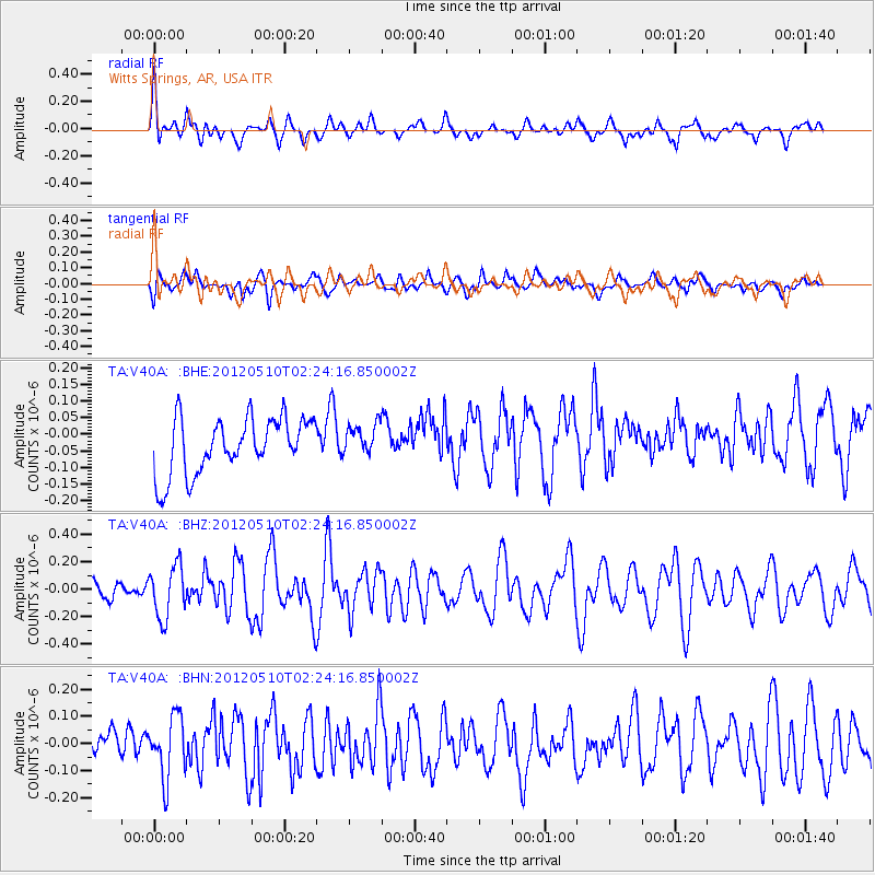
V40A Witts Springs, AR, USA - Earthquake Result Viewer
*The percent match for this event was below the threshold and hence no stack was calculated.
| Earthquake location: |
Easter Island Region |
| Earthquake latitude/longitude: |
-28.7/-112.6 |
| Earthquake time(UTC): |
2012/05/10 (131) 02:13:56 GMT |
| Earthquake Depth: |
10 km |
| Earthquake Magnitude: |
5.8 MS, 5.3 MB, 5.9 MW, 5.8 MW |
| Earthquake Catalog/Contributor: |
WHDF/NEIC |
|
| Network: |
TA USArray Transportable Network (new EarthScope stations) |
| Station: |
V40A Witts Springs, AR, USA |
| Lat/Lon: |
35.80 N/92.82 W |
| Elevation: |
570 m |
|
| Distance: |
66.8 deg |
| Az: |
17.396 deg |
| Baz: |
198.845 deg |
| Ray Param: |
$rayparam |
*The percent match for this event was below the threshold and hence was not used in the summary stack. |
|
| Radial Match: |
67.28229 % |
| Radial Bump: |
400 |
| Transverse Match: |
57.08267 % |
| Transverse Bump: |
400 |
| SOD ConfigId: |
446234 |
| Insert Time: |
2012-08-05 05:36:57.536 +0000 |
| GWidth: |
2.5 |
| Max Bumps: |
400 |
| Tol: |
0.001 |
|
Signal To Noise
| Channel | StoN | STA | LTA |
| TA:V40A: :BHZ:20120510T02:24:16.850002Z | 3.5490763 | 1.8887707E-7 | 5.3218653E-8 |
| TA:V40A: :BHN:20120510T02:24:16.850002Z | 1.5440032 | 1.1283734E-7 | 7.3081026E-8 |
| TA:V40A: :BHE:20120510T02:24:16.850002Z | 0.5670422 | 4.7436362E-8 | 8.36558E-8 |
| Arrivals |
| Ps | |
| PpPs | |
| PsPs/PpSs | |


