You are here: Home > Network List > TA - USArray Transportable Network (new EarthScope stations) Stations List
> Station J39A Decorah, IA, USA > Earthquake Result Viewer
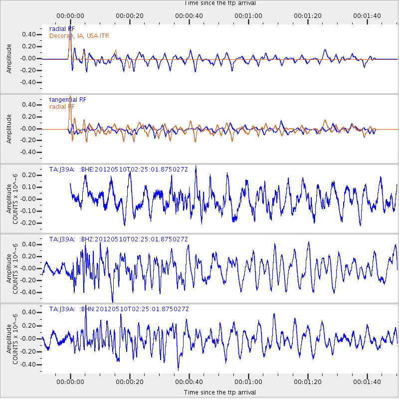
J39A Decorah, IA, USA - Earthquake Result Viewer
*The percent match for this event was below the threshold and hence no stack was calculated.
| Earthquake location: |
Easter Island Region |
| Earthquake latitude/longitude: |
-28.7/-112.6 |
| Earthquake time(UTC): |
2012/05/10 (131) 02:13:56 GMT |
| Earthquake Depth: |
10 km |
| Earthquake Magnitude: |
5.8 MS, 5.3 MB, 5.9 MW, 5.8 MW |
| Earthquake Catalog/Contributor: |
WHDF/NEIC |
|
| Network: |
TA USArray Transportable Network (new EarthScope stations) |
| Station: |
J39A Decorah, IA, USA |
| Lat/Lon: |
43.34 N/91.71 W |
| Elevation: |
350 m |
|
| Distance: |
74.2 deg |
| Az: |
15.678 deg |
| Baz: |
198.982 deg |
| Ray Param: |
$rayparam |
*The percent match for this event was below the threshold and hence was not used in the summary stack. |
|
| Radial Match: |
61.59967 % |
| Radial Bump: |
400 |
| Transverse Match: |
47.857662 % |
| Transverse Bump: |
400 |
| SOD ConfigId: |
446234 |
| Insert Time: |
2012-08-05 05:39:02.840 +0000 |
| GWidth: |
2.5 |
| Max Bumps: |
400 |
| Tol: |
0.001 |
|
Signal To Noise
| Channel | StoN | STA | LTA |
| TA:J39A: :BHZ:20120510T02:25:01.875027Z | 2.3769882 | 1.781486E-7 | 7.494719E-8 |
| TA:J39A: :BHN:20120510T02:25:01.875027Z | 1.0101314 | 1.0153047E-7 | 1.0051214E-7 |
| TA:J39A: :BHE:20120510T02:25:01.875027Z | 0.8050911 | 6.9585596E-8 | 8.643195E-8 |
| Arrivals |
| Ps | |
| PpPs | |
| PsPs/PpSs | |


