You are here: Home > Network List > TA - USArray Transportable Network (new EarthScope stations) Stations List
> Station R43A Red Bud, IL, USA > Earthquake Result Viewer
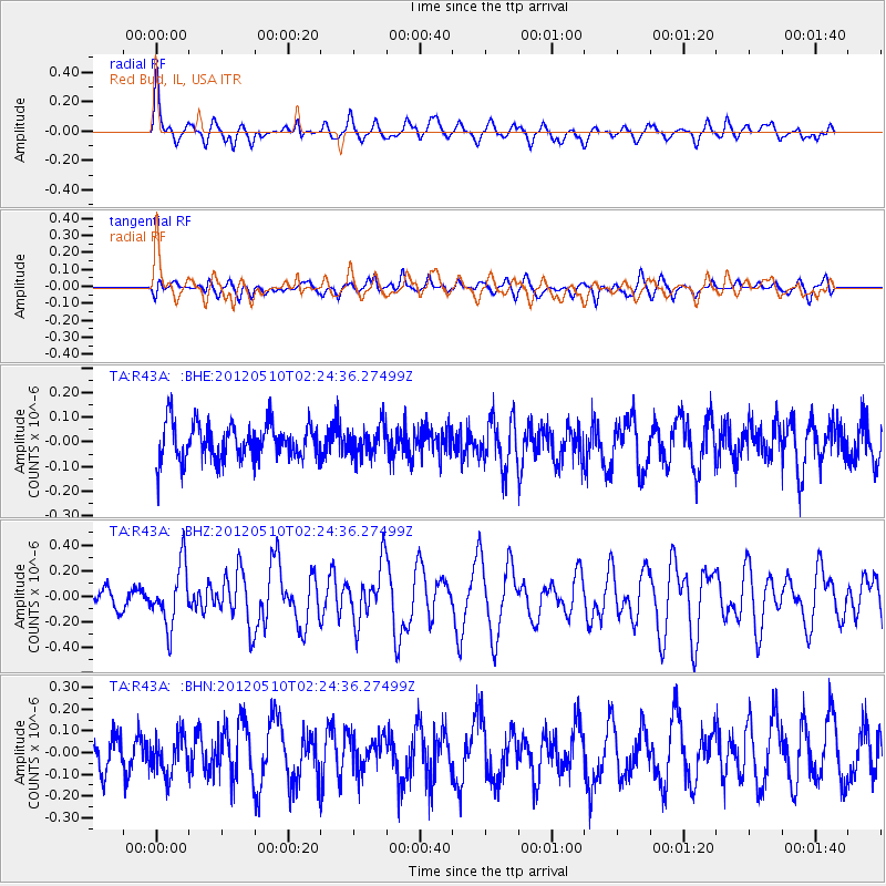
R43A Red Bud, IL, USA - Earthquake Result Viewer
*The percent match for this event was below the threshold and hence no stack was calculated.
| Earthquake location: |
Easter Island Region |
| Earthquake latitude/longitude: |
-28.7/-112.6 |
| Earthquake time(UTC): |
2012/05/10 (131) 02:13:56 GMT |
| Earthquake Depth: |
10 km |
| Earthquake Magnitude: |
5.8 MS, 5.3 MB, 5.9 MW, 5.8 MW |
| Earthquake Catalog/Contributor: |
WHDF/NEIC |
|
| Network: |
TA USArray Transportable Network (new EarthScope stations) |
| Station: |
R43A Red Bud, IL, USA |
| Lat/Lon: |
38.28 N/89.93 W |
| Elevation: |
186 m |
|
| Distance: |
69.9 deg |
| Az: |
18.829 deg |
| Baz: |
201.109 deg |
| Ray Param: |
$rayparam |
*The percent match for this event was below the threshold and hence was not used in the summary stack. |
|
| Radial Match: |
77.610916 % |
| Radial Bump: |
400 |
| Transverse Match: |
55.673077 % |
| Transverse Bump: |
400 |
| SOD ConfigId: |
446234 |
| Insert Time: |
2012-08-05 05:39:46.345 +0000 |
| GWidth: |
2.5 |
| Max Bumps: |
400 |
| Tol: |
0.001 |
|
Signal To Noise
| Channel | StoN | STA | LTA |
| TA:R43A: :BHZ:20120510T02:24:36.27499Z | 3.8580966 | 2.3647743E-7 | 6.129381E-8 |
| TA:R43A: :BHN:20120510T02:24:36.27499Z | 1.1631391 | 8.827384E-8 | 7.5892764E-8 |
| TA:R43A: :BHE:20120510T02:24:36.27499Z | 0.80259544 | 5.9295783E-8 | 7.388004E-8 |
| Arrivals |
| Ps | |
| PpPs | |
| PsPs/PpSs | |


