You are here: Home > Network List > TA - USArray Transportable Network (new EarthScope stations) Stations List
> Station W48A Pulaski, TN, USA > Earthquake Result Viewer
W48A Pulaski, TN, USA - Earthquake Result Viewer

| Earthquake location: |
Easter Island Region |
| Earthquake latitude/longitude: |
-28.7/-112.6 |
| Earthquake time(UTC): |
2012/05/10 (131) 02:13:56 GMT |
| Earthquake Depth: |
10 km |
| Earthquake Magnitude: |
5.8 MS, 5.3 MB, 5.9 MW, 5.8 MW |
| Earthquake Catalog/Contributor: |
WHDF/NEIC |
|
| Network: |
TA USArray Transportable Network (new EarthScope stations) |
| Station: |
W48A Pulaski, TN, USA |
| Lat/Lon: |
35.14 N/86.93 W |
| Elevation: |
260 m |
|
| Distance: |
68.0 deg |
| Az: |
22.503 deg |
| Baz: |
204.213 deg |
| Ray Param: |
0.05659965 |
| Estimated Moho Depth: |
34.75 km |
| Estimated Crust Vp/Vs: |
2.10 |
| Assumed Crust Vp: |
6.476 km/s |
| Estimated Crust Vs: |
3.087 km/s |
| Estimated Crust Poisson's Ratio: |
0.35 |
|
| Radial Match: |
81.99966 % |
| Radial Bump: |
400 |
| Transverse Match: |
51.962345 % |
| Transverse Bump: |
400 |
| SOD ConfigId: |
446234 |
| Insert Time: |
2012-08-05 05:41:48.615 +0000 |
| GWidth: |
2.5 |
| Max Bumps: |
400 |
| Tol: |
0.001 |
|
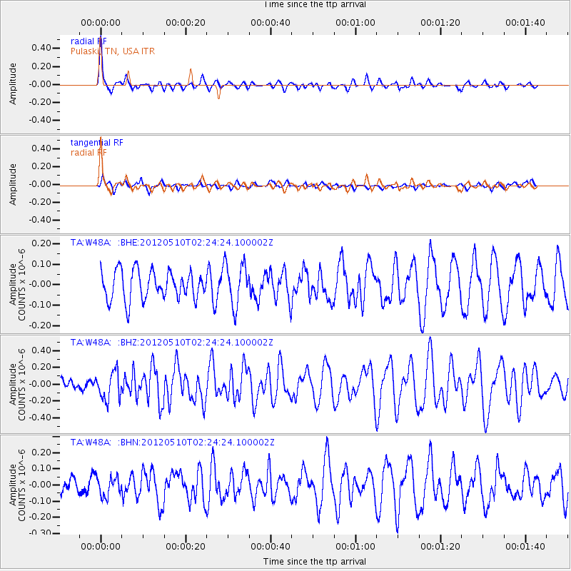
Signal To Noise
| Channel | StoN | STA | LTA |
| TA:W48A: :BHZ:20120510T02:24:24.100002Z | 2.2862551 | 1.6954156E-7 | 7.415689E-8 |
| TA:W48A: :BHN:20120510T02:24:24.100002Z | 0.8824154 | 5.8002374E-8 | 6.573137E-8 |
| TA:W48A: :BHE:20120510T02:24:24.100002Z | 1.5162185 | 1.0507173E-7 | 6.929854E-8 |
| Arrivals |
| Ps | 6.1 SECOND |
| PpPs | 16 SECOND |
| PsPs/PpSs | 22 SECOND |


