You are here: Home > Network List > TA - USArray Transportable Network (new EarthScope stations) Stations List
> Station J46A Howard City, MI, USA > Earthquake Result Viewer
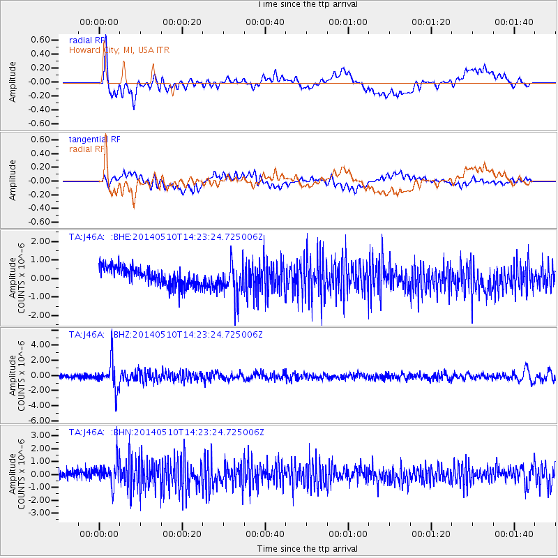
J46A Howard City, MI, USA - Earthquake Result Viewer
*The percent match for this event was below the threshold and hence no stack was calculated.
| Earthquake location: |
Southern Alaska |
| Earthquake latitude/longitude: |
60.0/-152.2 |
| Earthquake time(UTC): |
2014/05/10 (130) 14:16:08 GMT |
| Earthquake Depth: |
96 km |
| Earthquake Magnitude: |
5.8 ML, 5.5 MI, 5.7 MWP |
| Earthquake Catalog/Contributor: |
NEIC PDE/NEIC COMCAT |
|
| Network: |
TA USArray Transportable Network (new EarthScope stations) |
| Station: |
J46A Howard City, MI, USA |
| Lat/Lon: |
43.35 N/85.65 W |
| Elevation: |
275 m |
|
| Distance: |
42.5 deg |
| Az: |
82.146 deg |
| Baz: |
316.981 deg |
| Ray Param: |
$rayparam |
*The percent match for this event was below the threshold and hence was not used in the summary stack. |
|
| Radial Match: |
58.025185 % |
| Radial Bump: |
400 |
| Transverse Match: |
52.554943 % |
| Transverse Bump: |
400 |
| SOD ConfigId: |
3390531 |
| Insert Time: |
2019-04-11 19:29:44.170 +0000 |
| GWidth: |
2.5 |
| Max Bumps: |
400 |
| Tol: |
0.001 |
|
Signal To Noise
| Channel | StoN | STA | LTA |
| TA:J46A: :BHZ:20140510T14:23:24.725006Z | 9.492986 | 1.9023491E-6 | 2.0039523E-7 |
| TA:J46A: :BHN:20140510T14:23:24.725006Z | 2.975145 | 9.786594E-7 | 3.2894508E-7 |
| TA:J46A: :BHE:20140510T14:23:24.725006Z | 1.7126422 | 8.266859E-7 | 4.826962E-7 |
| Arrivals |
| Ps | |
| PpPs | |
| PsPs/PpSs | |


