You are here: Home > Network List > TA - USArray Transportable Network (new EarthScope stations) Stations List
> Station J41A Loganville, WI, USA > Earthquake Result Viewer
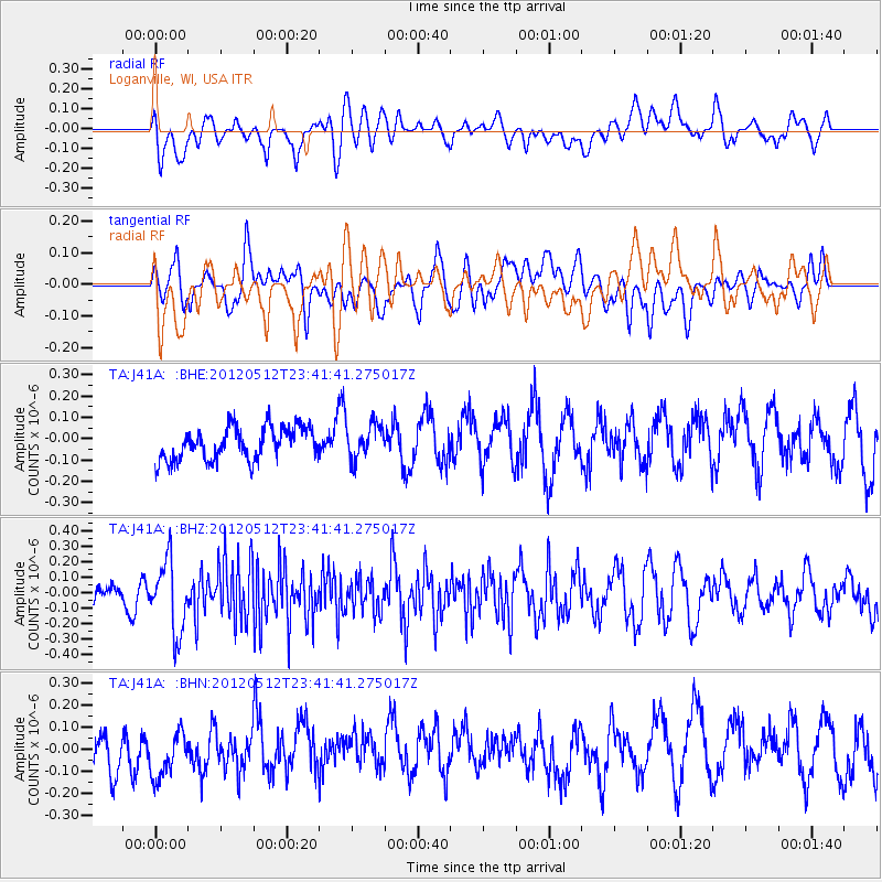
J41A Loganville, WI, USA - Earthquake Result Viewer
*The percent match for this event was below the threshold and hence no stack was calculated.
| Earthquake location: |
Afghanistan-Tajikistan Bord Reg. |
| Earthquake latitude/longitude: |
38.6/70.4 |
| Earthquake time(UTC): |
2012/05/12 (133) 23:28:43 GMT |
| Earthquake Depth: |
10 km |
| Earthquake Magnitude: |
6.0 MB, 5.7 MS, 5.7 MW, 5.9 MW |
| Earthquake Catalog/Contributor: |
WHDF/NEIC |
|
| Network: |
TA USArray Transportable Network (new EarthScope stations) |
| Station: |
J41A Loganville, WI, USA |
| Lat/Lon: |
43.37 N/90.01 W |
| Elevation: |
360 m |
|
| Distance: |
96.5 deg |
| Az: |
345.723 deg |
| Baz: |
15.362 deg |
| Ray Param: |
$rayparam |
*The percent match for this event was below the threshold and hence was not used in the summary stack. |
|
| Radial Match: |
47.256187 % |
| Radial Bump: |
400 |
| Transverse Match: |
50.425392 % |
| Transverse Bump: |
400 |
| SOD ConfigId: |
446234 |
| Insert Time: |
2012-08-05 06:03:57.387 +0000 |
| GWidth: |
2.5 |
| Max Bumps: |
400 |
| Tol: |
0.001 |
|
Signal To Noise
| Channel | StoN | STA | LTA |
| TA:J41A: :BHZ:20120512T23:41:41.275017Z | 1.9781092 | 2.3155292E-7 | 1.17057695E-7 |
| TA:J41A: :BHN:20120512T23:41:41.275017Z | 1.3283006 | 1.2214392E-7 | 9.195502E-8 |
| TA:J41A: :BHE:20120512T23:41:41.275017Z | 1.0983602 | 8.3619405E-8 | 7.613114E-8 |
| Arrivals |
| Ps | |
| PpPs | |
| PsPs/PpSs | |


